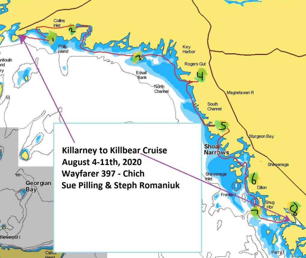
| From Killarney to Killbear – A Wayfarer
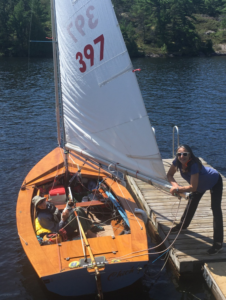
mirror image of a 1979 Mirror Dinghy Cruise updated 30 August 2020 at 2115 hrs ... 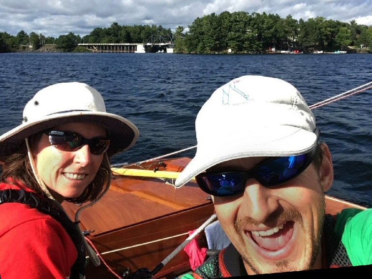 In a beautifully written and presented cruise log, Steph Romaniuk and Sue Pilling (above) re-trace her father's 1979 Mirror Dinghy route in reverse, sailing Chich Wayfarer 397 which father, Graham, in no small way brought back to lovely life. Sue’s Dad and three
other solo sailors braved this trip up the small craft
channel in 1979 (see page 8). They
pulled their 11- foot Mirror dinghies up on rocks and
camped on shore. From August 4th to 11th, Sue Pilling
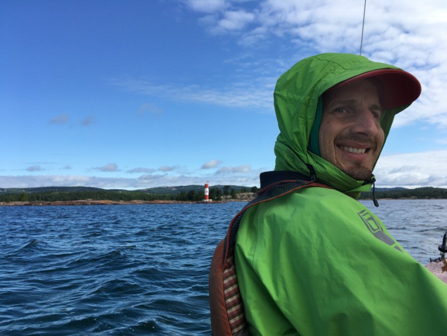
and I (Steph Romaniuk) took our 16-foot Wayfarer
sailboat which is harder to pull up on rocks, so we
anchored off and tented or slept aboard in our boom
tent with stern line tied to shore to pull us close in
to wading depth. We kept a sharp eye on the weather
(VHF, Windfinder App, Environment Canada Weather App).
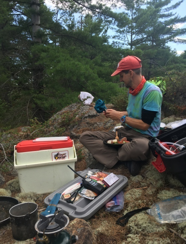
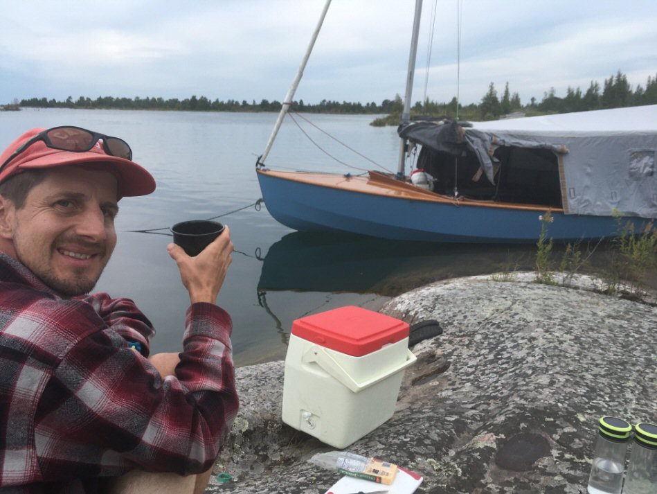
We had a Nomad 7+ USB solar charger with us as well to
keep battery life up. For navigation we used paper
strip charts (2202, 2203 and 2204) and had back-up
Navionics App on the iPad (this is where we took the
screen shots like the one below). It is like a chart
plotter - tells you were you are and where you are
heading, and you can Zoom in really close and get lots
of details of rocks, shoals, etc. It is amazing
how accurately people before us charted these waters.
Because the Wayfarer can get its centreboard and
rudder up quickly, we can get into some really
shallow, quiet spots that others cannot get into.
 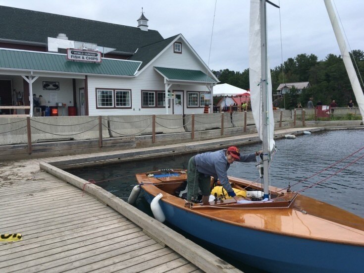 In Killarney we
had a good feed of Fish and Chips and it was later
than we had planned before setting off Tuesday at
5pm in cloudy conditions with a northerly wind about
5-10 knots.
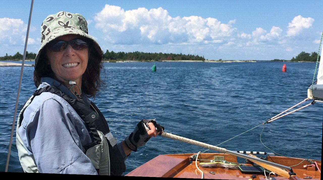
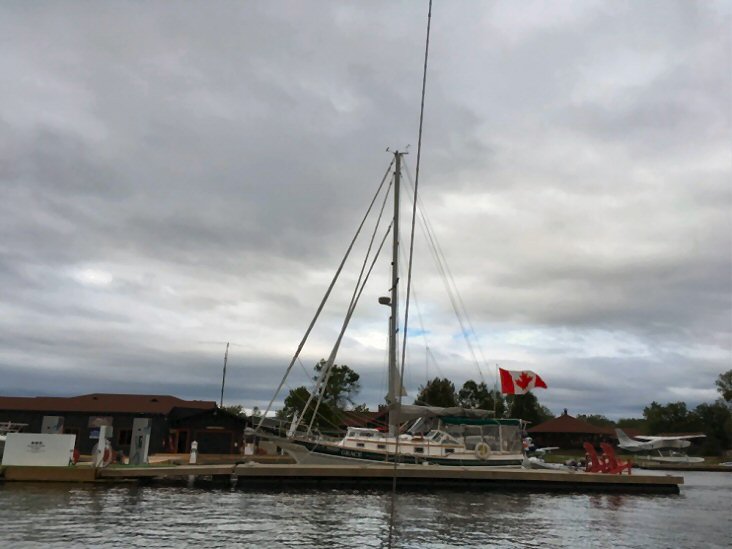 We passed this cutter-rig sailboat on our way out of Killarney and ran into him later in Bayfield Inlet and Shawanaga Bay! |
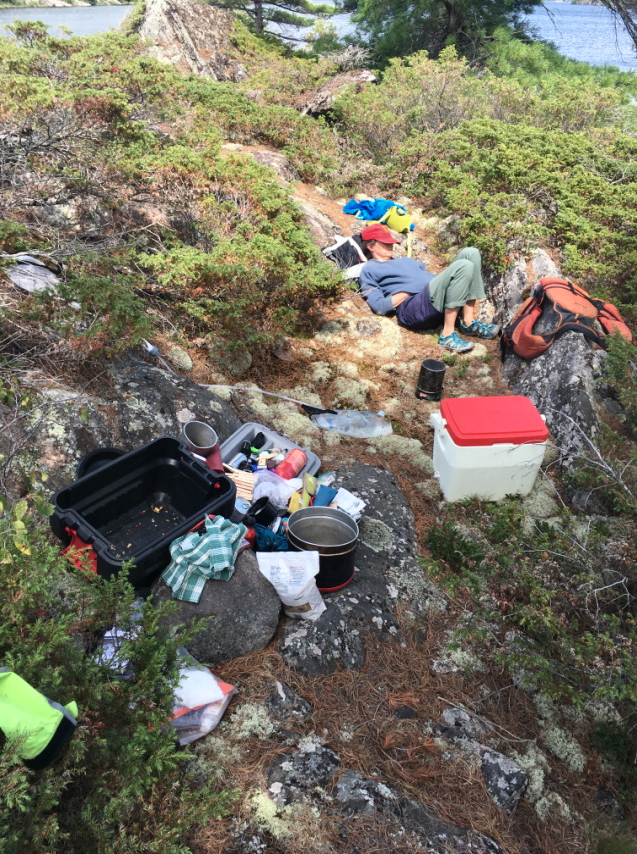
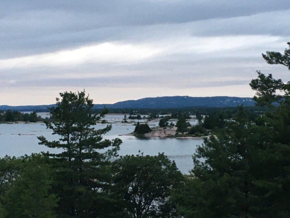 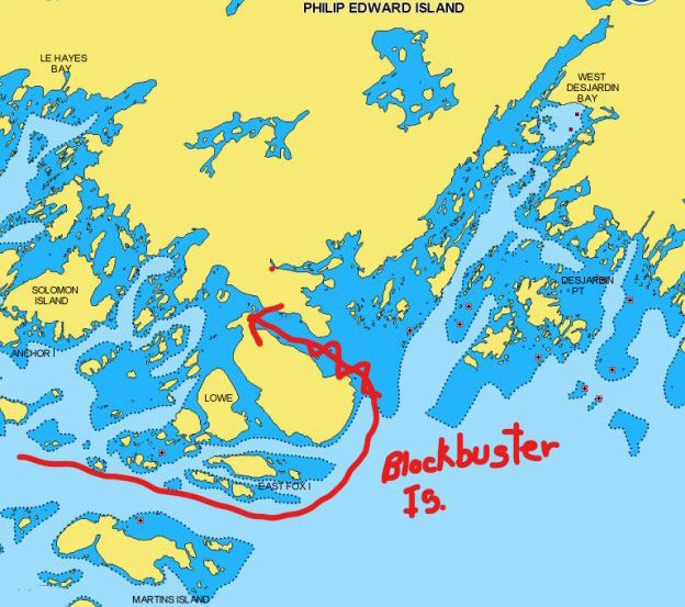 That first
night we decided to head out to Blockbuster Island
among the Fox Islands south of Phillip Edward
Island (PEI). There was a strong-wind warning for
the next day so this was our only chance to see
these beautiful and exposed outer islands. We got
the anchor positioned first try! It allowed us to
paddle our stern to shore and have just enough
rode to meet a flat rock. We tented (below) so we
could make an early getaway to backtrack upwind
for a bit and tuck in behind the shelter of PEI
into Collins Inlet, just as the wind piped up.
We’ll need to come back here someday. 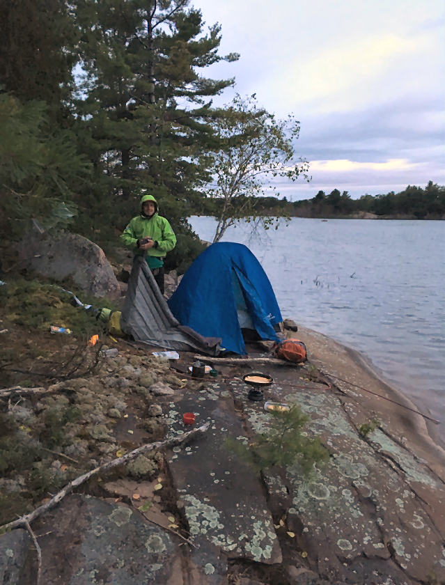 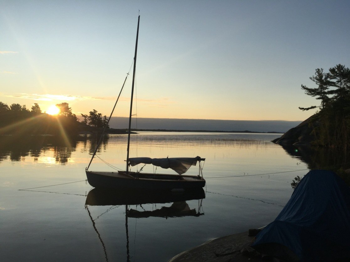 The early start Wednesday rewarded us with a stunning sunrise. |
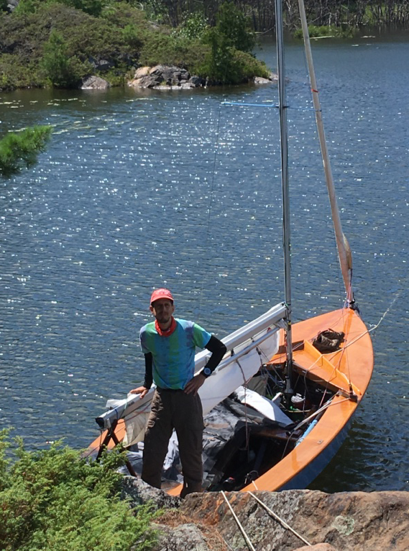
 That is a smile on Steph's face as we reached Flat Rock Lighthouse that marks the entrance to Collins Inlet. Now we could run with the strong wind at our back through most of this inlet with ease – a bit gusty for the spinnaker. The Mirrors somehow managed to sail the other direction upwind tacking through this narrow channel – must’ve taken them a long time!! We ran through eight miles of channel, past petroglyphs at mile 52 and tacked upwind into gusty Mill Lake with reefed sails. Our anchored boat was blowing towards shore, so we again slept in our tent to decrease the windage of the boom tent and increase our faith in the anchor. A good thing, too, as Chich was only half a foot from touching the rocks in the morning. 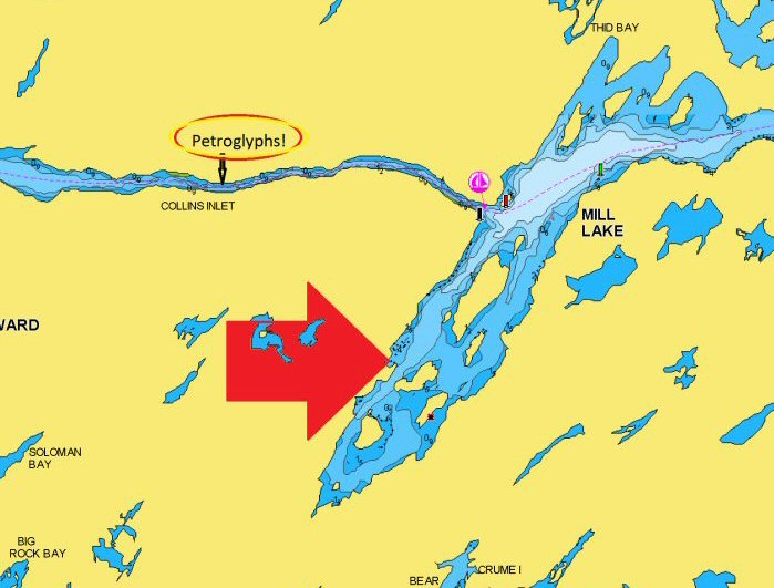 |
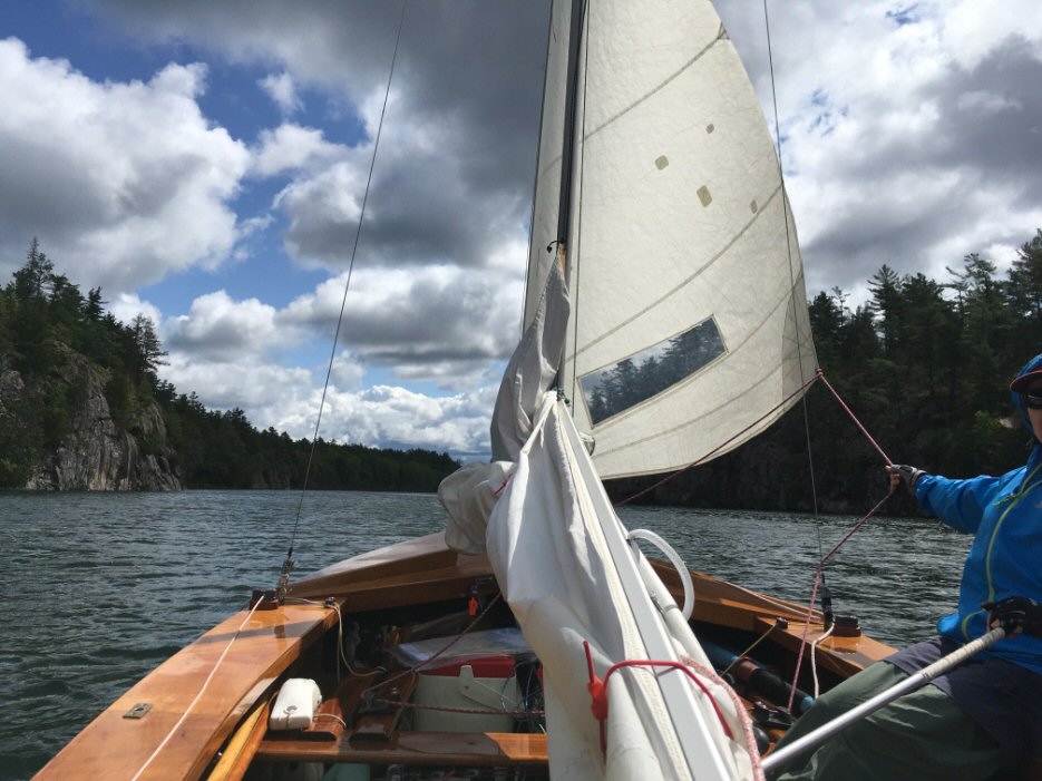 Running down the Inlet |
    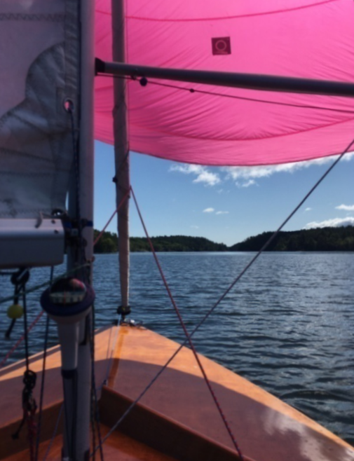  |
Thursday
morning (day 3) we headed out with spinnaker and
finished off the last 3 of 11 miles of Collins Inlet – a
couple marinas on the chart looked quiet. There are
still old pilings at Collins Inlet (the town). We wanted
to make the Bustard Islands so we didn’t dawdle – it was
the last day for a good westerly so we wanted to take
advantage of the wind. The last mile of the inlet was
trying – burgee spinning and motor boats passing before
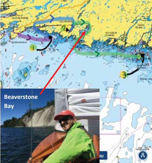
we navigated out the shallows into Beaverstone
Bay. It took about 2 hours to tack out of the bay.
We then headed outside the Chickens, framed by Rooster
Rock and Hen Island :)
and practiced our dead reckoning, setting our watch for
when to look out for the former - our speed estimate was
off as we almost hit it – eek! 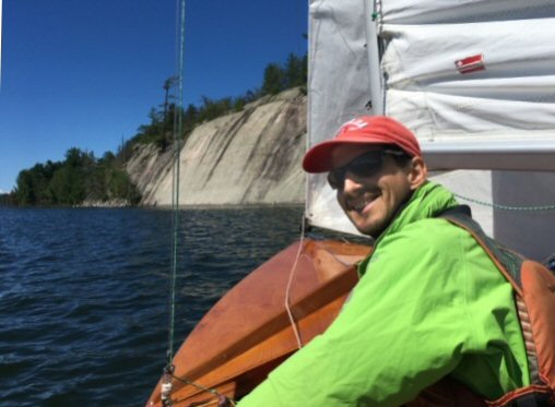 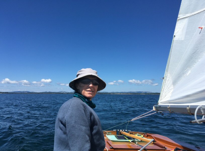 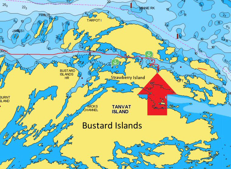 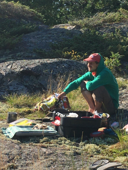 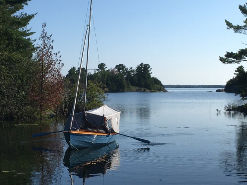 |
|
In case one
wished to shift location, we discovered that the oar
locks line up with the boom tent windows. Sue did a
test row around the anchorage.
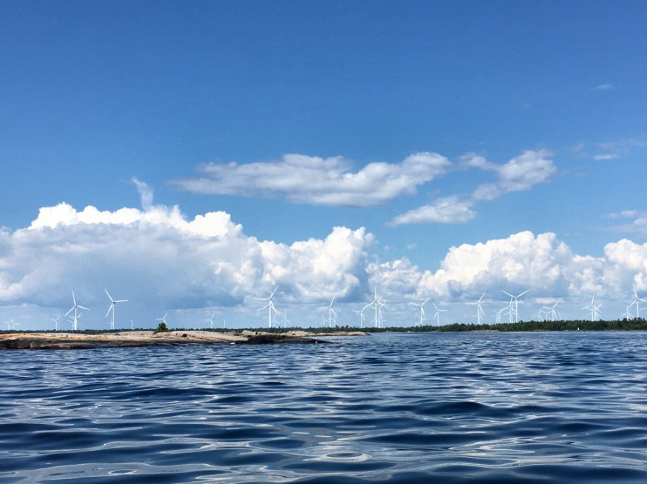   Friday morning (day 4), we reached out towards Key River in the top right-hand corner of Georgian Bay and passed the burned mainland from the Parry Sound 33 fire last summer and marvelled at the Henvey Inlet wind farm project (above). You’d think that being on a long tack like that would give an opportunity to stop navigating and read or work on the cruise log, but we almost ended up going south of Dead Island into shoals. We headed north in the light southerly just in time and reunited with the small craft channel. This long day brought us all the way into Byng Inlet. 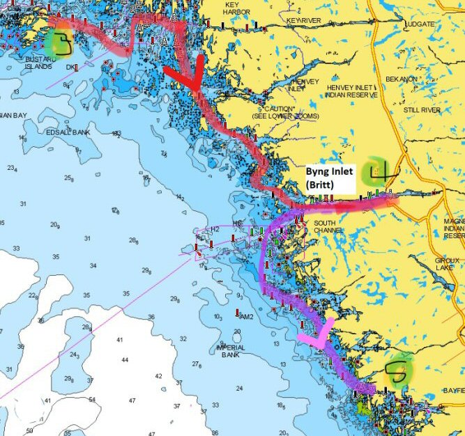 We were running
up the inlet to overnight at the public dock when, all
of a sudden, a voice called from a dock, “Get over
here – it's about time you showed up!”
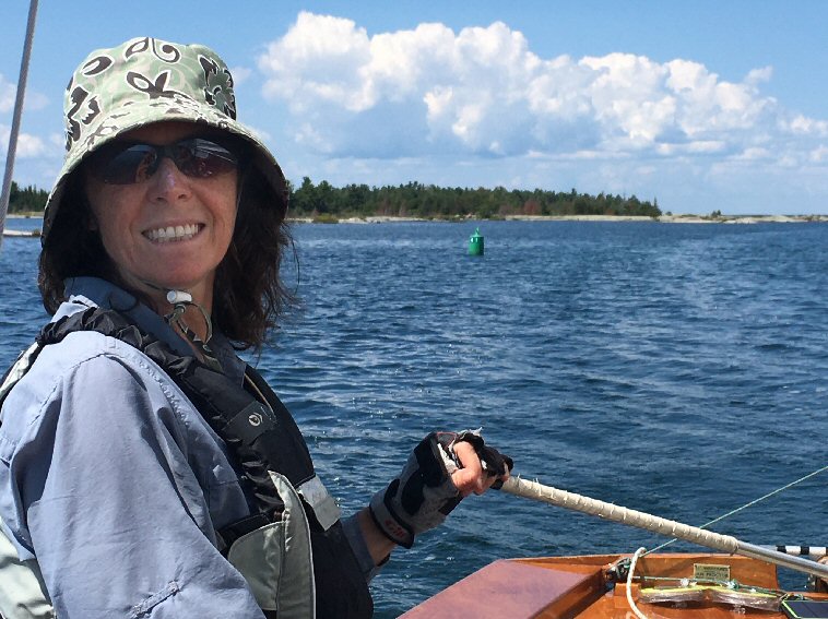
 It was our friend, Karen (above)! We had a standing invite but had not known where she lived. In a great visit with Karen, we shared a beer and got spoiled with a bed, private quarters, pizza, pie and and her delightful dog, Reggie (above). (Al's note: the dog reminds me of a truly fine joke. 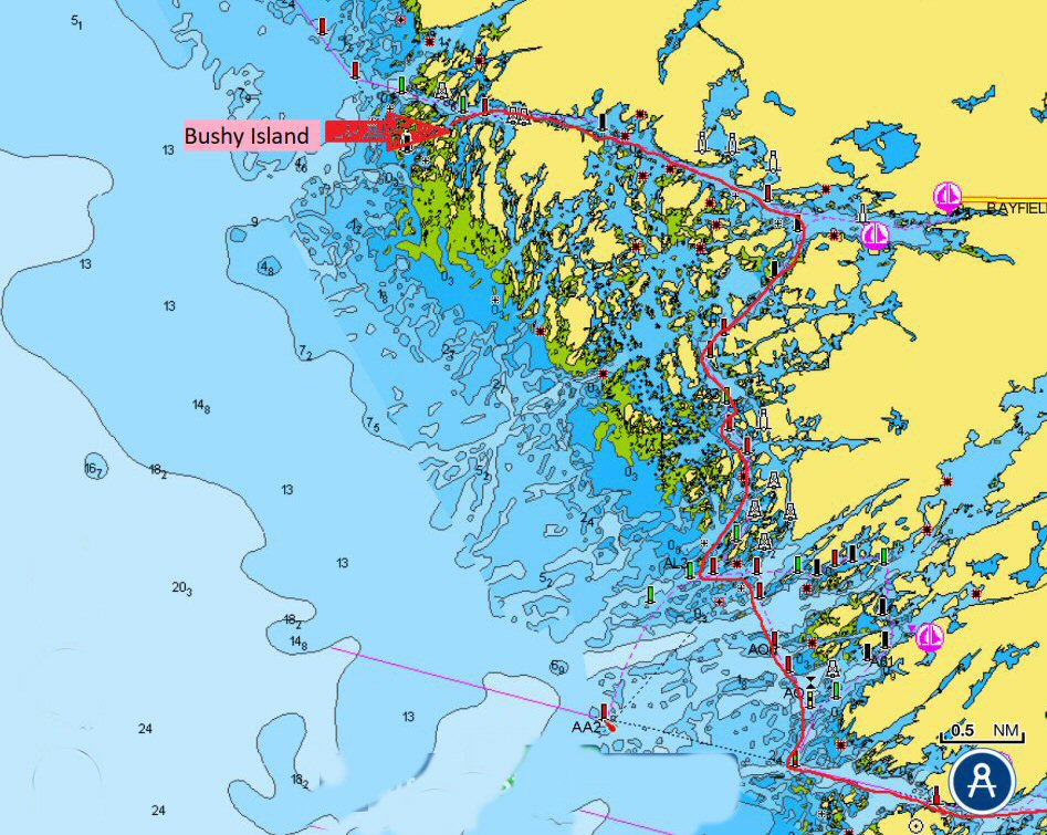 Britt was supposed
to be the end point of
our cruise. But Sue was
even more eager to sail all the way to Parry Sound's
Killbear Park, just like her father had done in 1979,
now that these last two big sailing days had put that
goal well within reach. After
borrowing a second anchor (which works better than a
basket of rocks), we set off for Bayfield Inlet at noon Saturday (day 5). After tacking
out of Byng Inlet, we headed south on a close reach in
a light southwesterly most of the day, but some tight
channels were dead upwind work. We survived Roger’s
Gut but went out around Cunningham’s Channel and
danced around some shoals. As we entered Bayfield
Inlet, we tucked into Bushy Island’s lee for the
night. We had fun exploring the rocks and found an
abandoned hunt camp.
 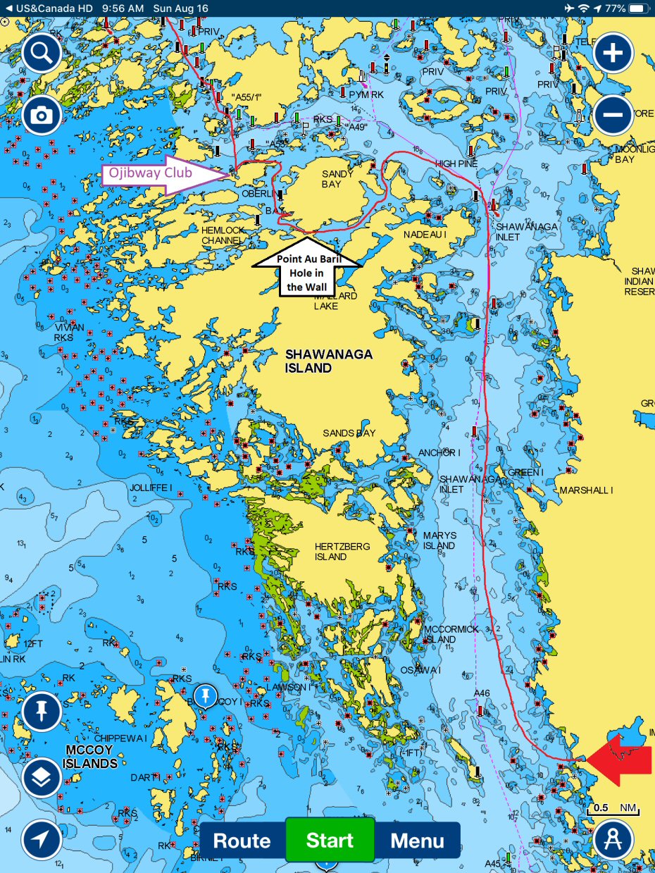 Sunday (day 5): The small craft channel leads into and then out of Bayfield Inlet where we saw the shoals that had protected us from the breaking waves and lulled us to sleep the previous night. A little unnerving tacking up through the narrow channel with churning shoals on all sides. Waves had built up as a south-westerly strengthened overnight. As we passed Point Au Baril (the point with its lighthouse - the town is Point Au Baril Station), we noticed a barrel up on a post (below) and laughed at the pun, but failed to read the sign that went with it and now we’re curious what it says. The lighthouse and a tower behind it set up the range for the approach. We lunched at the Ojibway Club, a massive 114-year-old hotel! 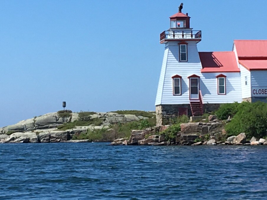 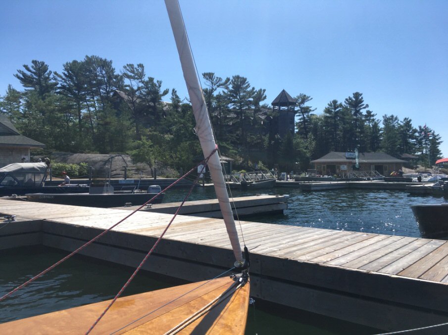 The posh Ojibway Club boasts tennis courts, restaurant, store, gift shop, gas dock, and more! 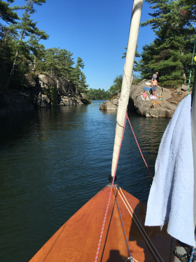 We decided to risk the doldrums south of Ojibway Island so that we could go through the Point Au Baril version of the Hole in the Wall. A kid jumped off the 40-foot cliff just as we passed and the friendly dog on the cliff in the photo nearly jumped into our boat! 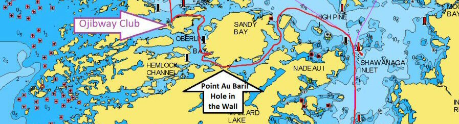 |
|
The wind
continued to decline so we were unsure if we’d make
Franklin Island that night. It was funny seeing the
ETA on Navionics skyrocket to after midnight in a
lull.
We made use of our iHunter Crown Land App and found a spot on the mainland coast in a small bay Sunday night (arrow below). 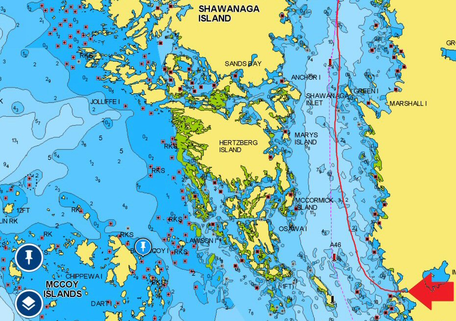 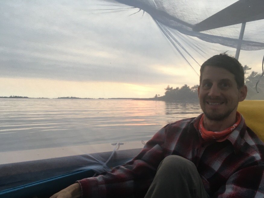 Will this be a mistake? You can see the look of doubt on Steph’s face as dusk looms. The idea was to sleep out with just a bug net under the stars to see the Perseid meteor shower - big mistake! Mosquitoes had us for dinner from dusk to past 11pm. 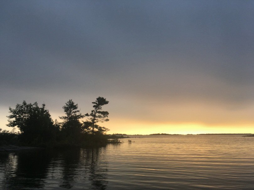  Our
experiences with mozzies and Shawanaga Bay were
eerily similar to those from the 1979 Mirror cruise
from Parry Sound to Killarney. Below is a part of
their log that was published in GAM Magazine back in the day. We also have the full log for those with a thirst for more reading about that 1979 cruise. 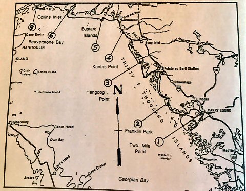 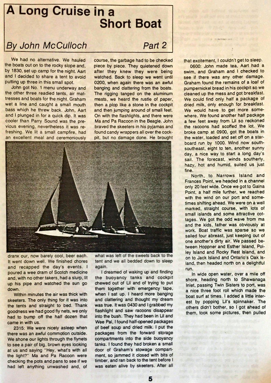  |
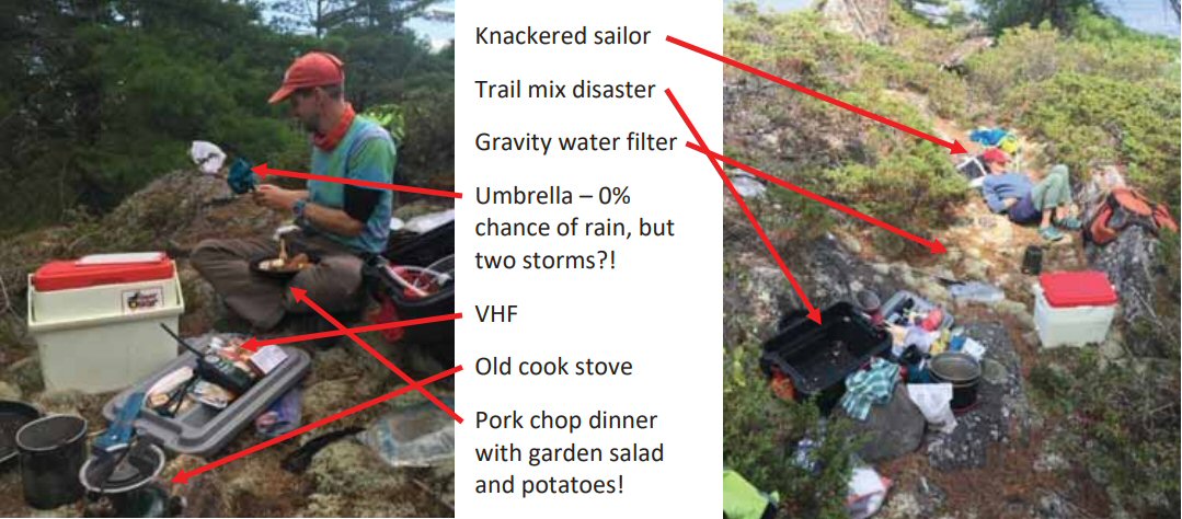
 Suffice it to say, we needed to take it easy the next day (Monday, day 6), so we sailed only seven more miles to the planned destination on Franklin Island (above). We entered the large bay behind Windsor rock, over a shoal (don’t ask), and into a nice little spot off the large bay (below).  The day and a half of sewing a bug screen into our boom tent was well worth it on this cruise to keep us bite free as long as we set it up at the right time. It also managed to keep that insane downpour of 3” in three hours out that night – it wouldn’t stop the three lightning bolts that landed bone-shakingly close though. We could see the clouds approaching (below) as we ate the only freeze-dried meal of the trip – we brought five! Lol.  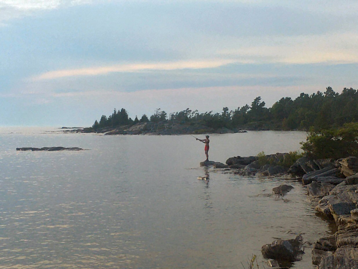 Early arrival at Franklin Island allowed for the vacation we had envisioned: we relaxed, did some reading and we even got the fishing gear out – Sue caught a 6” bass on first cast... we released it. 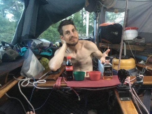 Care for a drink from our bar? It was pretty darn cool that only one rock outcrop was separating us from the open bay looking west. We even dug out the snorkeling gear on Tuesday morning (day 7) to swim around our little island. |
 After snorkelling, we
packed up and headed out of our sheltered
anchorage into strong north-westerlies – this was
a little hairy tacking through a small opening
with shoals everywhere. Why oh why did we try to
sail a Wayfarer upwind jib only with the
rudder kicked up? We luckily avoided shoals as
we bailed 180⁰, but made it out with only a
reefed main. Our next channel was dead
downwind in a good 15-knot blow, surfing the
waves to Killbear Provincial Park – a bit too
exciting! We felt more comfortable with the
inflatable head of the mainsail to keep us
from turtling if we’d capsized. The Aero
Luffspar jib furling and reef also gave us the
ability to lessen our sail area. Thanks, Ralph
Roberts! 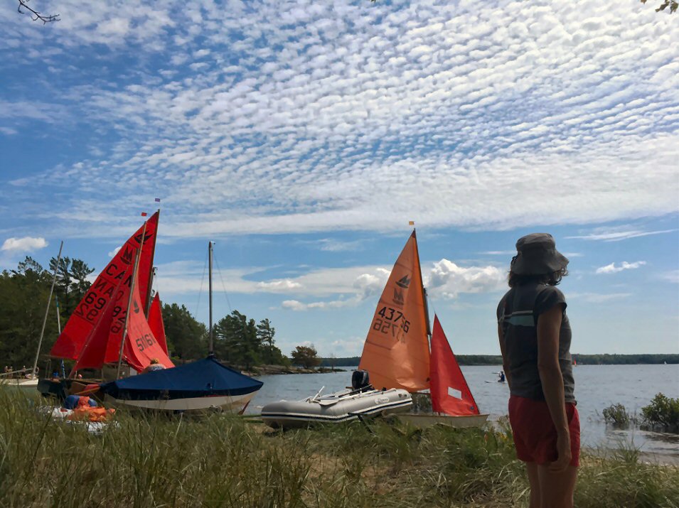 One week to the hour after leaving
Killarney, we arrived at Killbear's Harold Point
where our inspiration had begun and our voyage now
ended.
We spent the next 3 days hanging out with the Mirror crowd that Sue grew up with. They still gather annually. There were once 35 Mirrors lined up on this beach – now sadly only four … 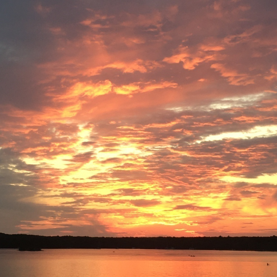 We took in one last Diving Rocks sunset
before Sue made the solo sail/row back to Parry
Sound the next day.
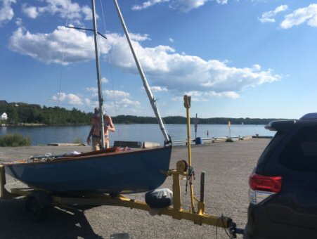 Steph had retrieved the truck and trailer
from Killarney with a ride from his mother and
step-father, who had been house-sitting.
Sue had a long sail in light air and upwind – and she finally got to use those oars we carted all the way down the bay from Killarney. THE END ... or maybe we should try it in the Mirror? |