July 1998
Ralph Roberts and Cedric Clarke (W9885 - Spree Lady)
with Bob and Clare Harland (W9933 - Sea Rocket)
Part 2 of a Log
written and illustrated by Ralph Roberts
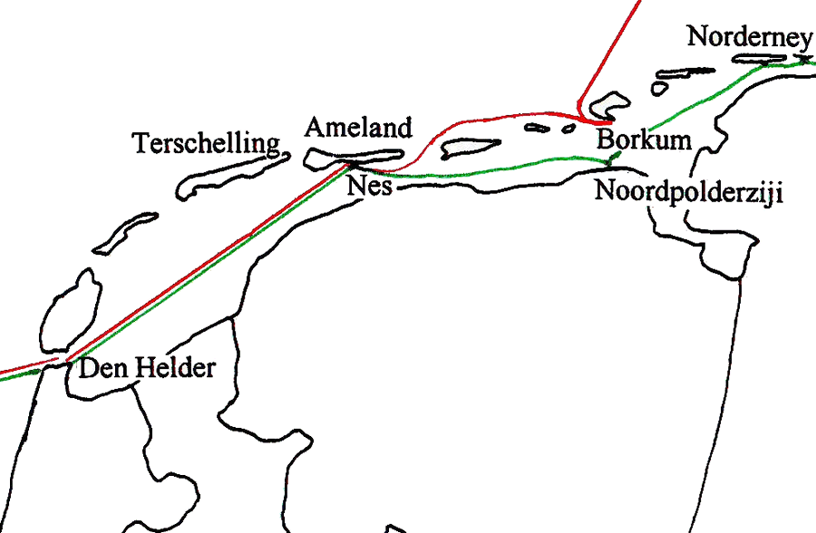
Part 2 - Den Helder
to Borkum
We
had arrived at Den Helder in a state of extreme tiredness, particularly
Clare,
who had helmed continuously for around
28 hours, and been awake for a further 15 hours prior to that.
Unfortunately we had
arrived on the very day the local naval base was putting on a sea and
air
display to entertain thousands of visitors. It was almost mid-morning
by the
time we had sorted out the formalities of a berth to stay for the
following
night, and made good use of the superb facilities of the nearby Naval
YC for a
welcome shower. We had then just finished clearing most of the gear
from the
boats, and putting up our boat tents to get our heads down to sleep,
when the
loud background music started up for the naval display. But we were far
too
tired for anything to keep us awake - well nearly anything: I did wake
up in
the early afternoon when a four-engined aircraft started making very
low level
sorties directly overhead, but I'm not sure even that woke Clare.
The
strong gale force winds which had been forecast, duly arrived late on
Sunday
afternoon. We were only too happy to retreat into our boat tents and go
back to
sleep again, the display now finished. The noise of the gale was almost
relaxing in comparison to the previous racket, and we slept very
soundly, warm
and snug inside our tents and sleeping bags.
Monday 13th July
The gale blew steadily
all through Sunday night, but had abated by
next morning, though the winds were still very strong. It was marginal
as to
whether it would be sensible to run on jib only to our next proposed
stop at
Terschelling. In the end the decision not to venture out was made by
Bob, who
felt that it would be better to get the tear in the luff of his sail
repaired
properly by a local sailmaker, rather than carrying out a makeshift
repair
which might not last, particularly as there would be less chance of
finding a
sailmaker to do the job properly later on.
...Tuesday was wet and miserable
with continuing gale force winds. There was no alternative but stay
where we were for yet another day. More than two days of gale force
winds seemed almost unbelievable weather for mid-July, and meant that
we were now way behind schedule. We had expected to lose some time
through bad weather, but hadn't anticipated losing this amount of time
almost straight away. The day was spent exploring the immediate area
and making sure everything was fully prepared for our planned start the
next day.
...We woke early on the Wednesday,
determined to get away and continue with our cruise, attempting to
reach our differing destinations in Denmark in what time we had left.
Bob and Clare aimed to complete their trip by staying inshore of the
Friesian Islands, and sailing via the Kiel Canal all the way to
Rantzausminde on the island of Fyn; whilst Cedric and I wished to try
to get to Rantzausminde for the start of the International Rally, by
sailing the more direct sea route to Esbjerg to meet up with our car
and trailer, and then trail the boat overland to the event. We agreed
however, to sail together along the Friesian Islands as far as Ameland.
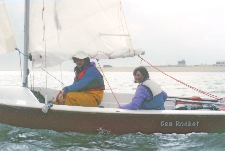
Bob and Clare enjoying the much more relaxed type of sailing in the Waddensea.
Bob in particular, was relieved to be able to sail without being laid low by sea-sickness.
The open space in the aft of the World allows for an extremely comfortable style of cruising, when sailing off the wind.
I also discarded my rear seats after seeing how much better it was without them.
Bob had been given a forecast of SW winds of F.4/5, so we set off under a reefed main and jib towards Terschelling. The Waddensea seemed so calm in comparison to our sea crossing, that we soon shook out the reef and changed to a genoa for a really exhilarating sail. With both the wind and a considerable flood tide assisting us, the GPS registered 8 to 10 knots. There were many other sailing boats around us for the first hour or so, but we were able to leave them in the distance as we sailed on a much more direct route over an area of shallow water towards Terschelling. We did overdo it a little in one place, and found ourselves skidding over the sandy bottom with both rudder and centreboard up, before retreating to deeper waters.West
Terschelling was
reached just after 1430 - a
distance of 30 n.m. which we had achieved in less than 5 hours.
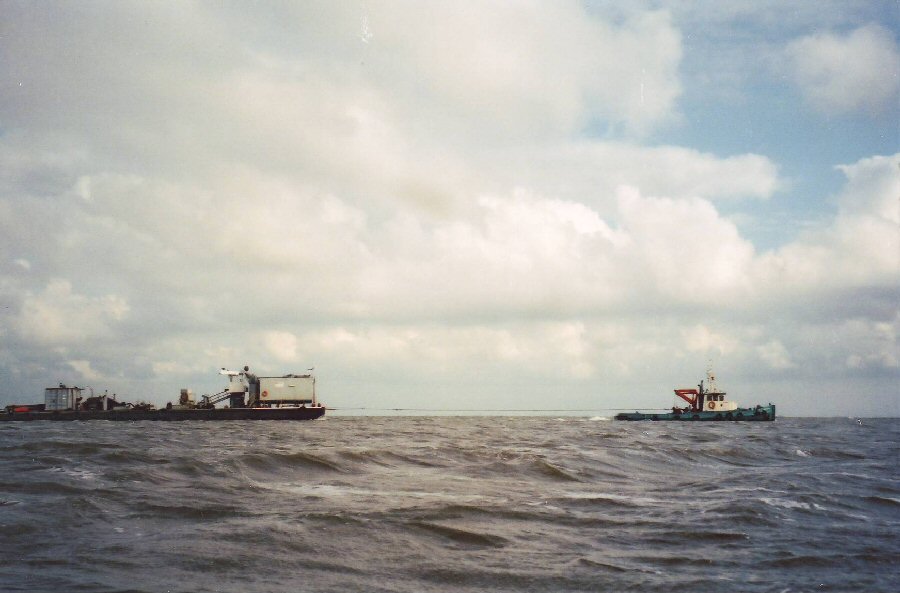
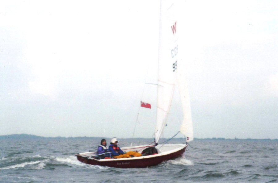
The channel buoys were frequently spaced quite widely apart, and It was often be easier to see
where the winding channels were by the various vessels using them.
It seemed
possible that we might be able to get as far as Nes on the island of Ameland
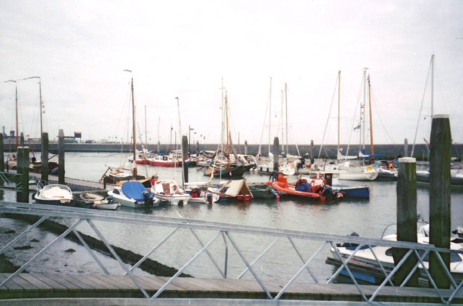
The harbour at Nes. Our two Wayfarers are in the middle of the pontoon above the gangplank.
Bob still has his boat tent covering the rear half of the boat, with the front section folded back.
...Bob and Clare enjoying the much more relaxed type of sailing in the Waddensea.
Bob in particular, was relieved to be able to sail without being laid low by sea-sickness.
The open space in the aft of the World allows for an extremely comfortable style of cruising, when sailing off the wind.
I also discarded my rear seats after seeing how much better it was without them.
Bob had been given a forecast of SW winds of F.4/5, so we set off under a reefed main and jib towards Terschelling. The Waddensea seemed so calm in comparison to our sea crossing, that we soon shook out the reef and changed to a genoa for a really exhilarating sail. With both the wind and a considerable flood tide assisting us, the GPS registered 8 to 10 knots. There were many other sailing boats around us for the first hour or so, but we were able to leave them in the distance as we sailed on a much more direct route over an area of shallow water towards Terschelling. We did overdo it a little in one place, and found ourselves skidding over the sandy bottom with both rudder and centreboard up, before retreating to deeper waters.
The channel buoys were frequently spaced quite widely apart, and It was often be easier to see
where the winding channels were by the various vessels using them.
The harbour at Nes. Our two Wayfarers are in the middle of the pontoon above the gangplank.
Bob still has his boat tent covering the rear half of the boat, with the front section folded back.
Next morning the
harbourmaster,
another of those people like the sailmaker in Den Helder
Bob and Clare would
continue their trip along the Waddensea, whilst Cedric and I would go
outside the islands to Borkum, our last stop, we had decided, before
sailing directly to Esbjerg. Sailing to seaward of the islands seemed
to be the
surest way of getting as far as Borkum in one day, for around low
water, the
Waddensea became a virtual sea of mud, interspersed with a few narrow
channels,
and we thought it unlikely we would reach Borkum within one day by
following the often
tortuous routes of these channels.
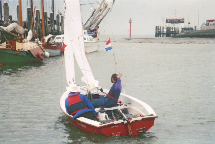
Bob and Clare packed up in their usual efficient manner, and were away by 10.30, impressing the harbourmaster, who watched them sail out and negotiate their way on the rising tide until he could no longer see them through his binoculars. They were to report later that sailing the Waddensea at low water was an ‘interesting’ experience, since all that could be seen were the mud banks either side of the various channels.
Cedric and I packed up in a more leisurely manner, waiting for the tide to rise to give us a shorter route to the end of the island. There was a heavy cloudburst just beforenoon , as we were ready to
depart. So we waited a little
longer, until the worst of the rain had passed. Not quite the ‘ideal’
weather
conditions we had hoped for! We set off a little while later in a light
breeze
and continuous drizzle, and quickly reached the end of the island. The
clearly
marked channel was an easy route to follow at first. Getting out to sea
however, proved much more of a problem than I had expected.
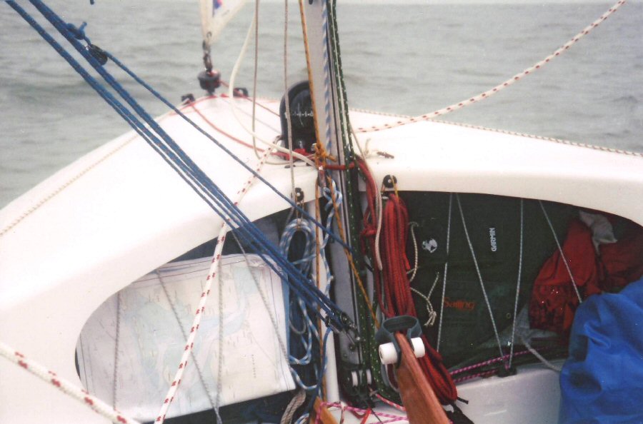
The detailed charts and GPS (held in position under the foredeck by shockcord)
proved essential to navigate between the islands and out to sea.
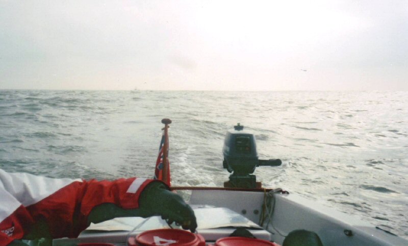
The outboard and ...
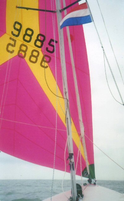
... the asymmetric spinnaker gave us the best possible speed sailing
against the current, which proved very strong, even keeping close inshore.
Even with a detailed chart, the route soon became more difficult to interpret, and had it not been for the GPS, I am sure I would have ended up back inside the islands. Breaking water always seemed to keep appearing around us - quite often ahead or to seaward! - and it took an hour or more before we were able to break free of the shallow water and set our course for Borkum.
When we reached the nextisland , Schiermonnikoog
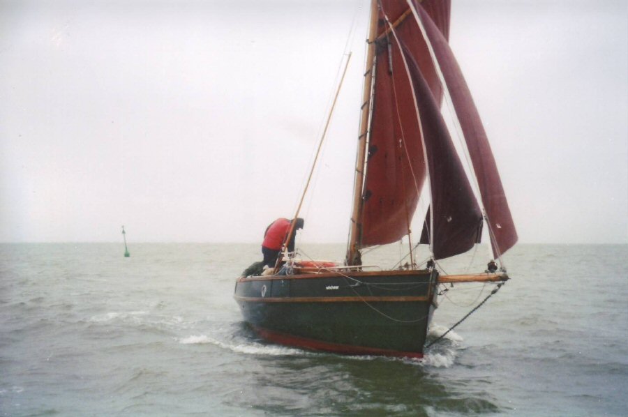
One of the many fine traditional Dutch sailing vessels we encountered on our sail through the Friesian Islands.
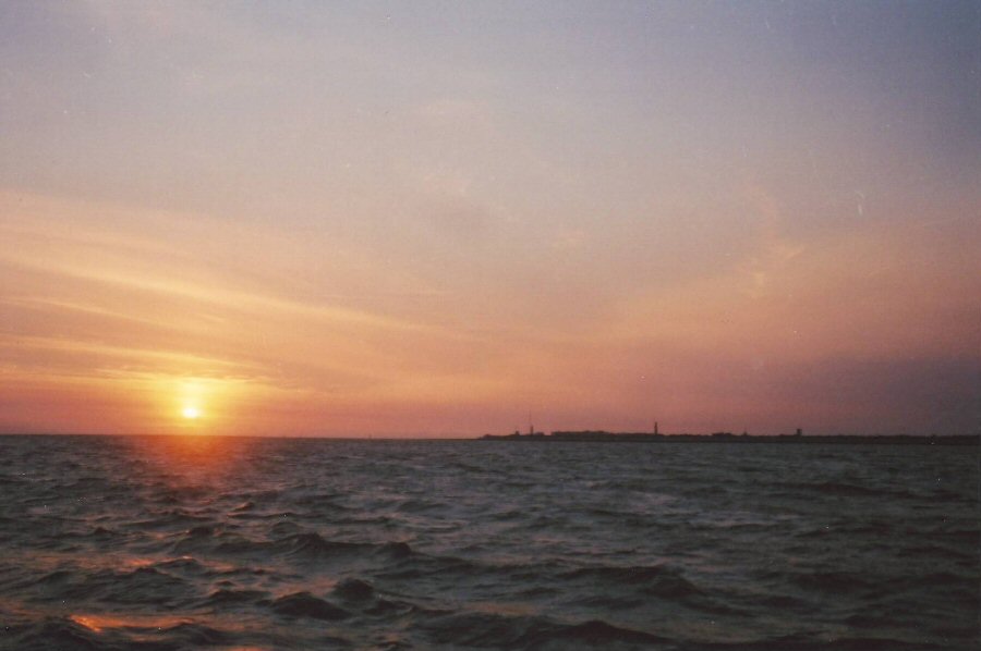
Approaching Borkum, the first of the German Friesian Islands, as the sun was setting -
though it still took us another 3 hours to reach the marina.
Borkum lighthouse eventually appeared on the horizon and we made easy progress until we reached theEms estuary, which proved
to be a very
uncomfortable crossing, with another wind over tide situation. I did
start to
change over the courtesy flags from Dutch to German halfway across, but
quickly
decided that following the correct flag etiquette wasn't worth risking
a
capsize. We entered the marina on the southernmost point of the island
just
after 2300, and set up our boat tent as quickly and quietly as we
could.
Unloading our gear quietly onto a rather creaky finger pontoon did
prove
somewhat difficult, but we were more than pleased to get our heads down
for a
well earned rest as soon as we had finished preparing the boat for the
night.
... Bob and Clare
departing from Nes to sail inshore of the Friesian Islands through the
Kiel Canal, and then on to the International Rally at Rantzausminde.
Kiel Canal, and then on to the International Rally at Rantzausminde.
Bob and Clare packed up in their usual efficient manner, and were away by 10.30, impressing the harbourmaster, who watched them sail out and negotiate their way on the rising tide until he could no longer see them through his binoculars. They were to report later that sailing the Waddensea at low water was an ‘interesting’ experience, since all that could be seen were the mud banks either side of the various channels.
Cedric and I packed up in a more leisurely manner, waiting for the tide to rise to give us a shorter route to the end of the island. There was a heavy cloudburst just before
The detailed charts and GPS (held in position under the foredeck by shockcord)
proved essential to navigate between the islands and out to sea.
The outboard and ...
... the asymmetric spinnaker gave us the best possible speed sailing
against the current, which proved very strong, even keeping close inshore.
Even with a detailed chart, the route soon became more difficult to interpret, and had it not been for the GPS, I am sure I would have ended up back inside the islands. Breaking water always seemed to keep appearing around us - quite often ahead or to seaward! - and it took an hour or more before we were able to break free of the shallow water and set our course for Borkum.
When we reached the next
One of the many fine traditional Dutch sailing vessels we encountered on our sail through the Friesian Islands.
Approaching Borkum, the first of the German Friesian Islands, as the sun was setting -
though it still took us another 3 hours to reach the marina.
Borkum lighthouse eventually appeared on the horizon and we made easy progress until we reached the