Two Wayfarers Sail to Denmark
July 1998
Ralph Roberts and Cedric Clarke (W9885 - Spree Lady)   
with Bob and Clare Harland (W9933 - Sea Rocket)
Part 3 of a Log
written and illustrated by Ralph Roberts

Part 3 - Borkum to Esbjerg

Friday 17th July

We woke next morning, refreshed after a good night’s sleep, and got up to make an early start. There was no sign of Bob and Clare, so we were sure they had found a convenient stop for the night elsewhere. The yacht moored next to us appeared to be empty, so we used it to hang out our sailing gear to dry.


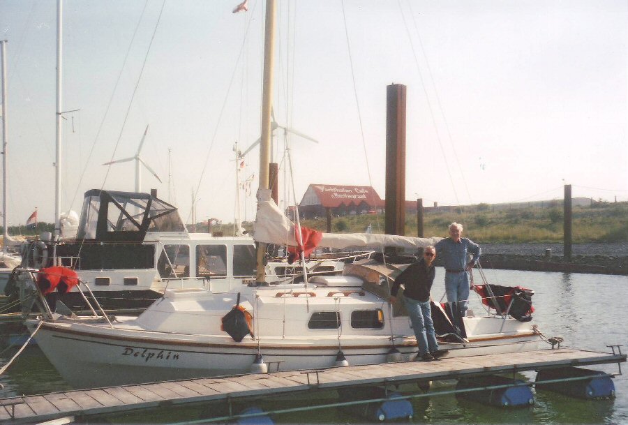
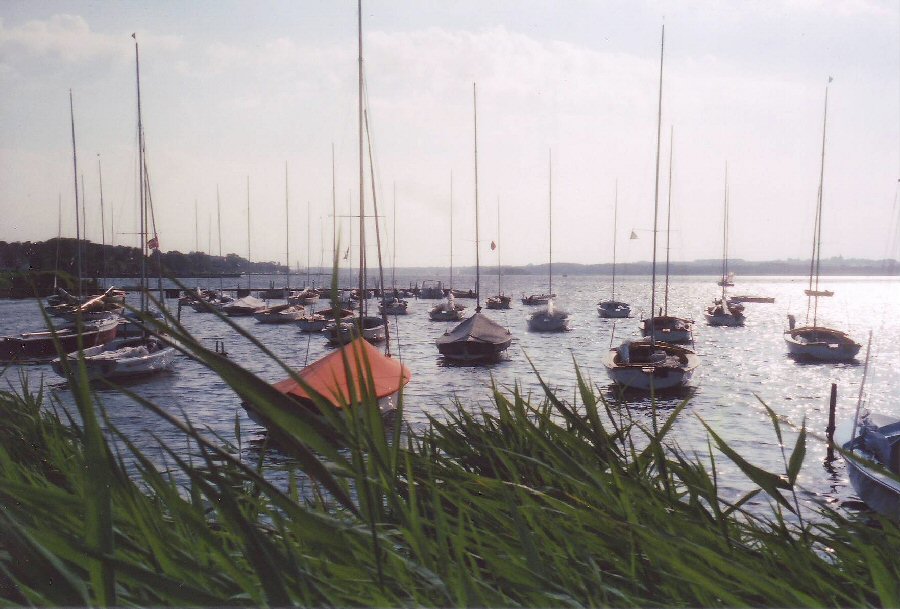
    Gerhard Becher and his crew on their yacht Dolphin, moored adjacent to us.
    Still with our offshore gear and various items of clothing spread out over his boat to dry!


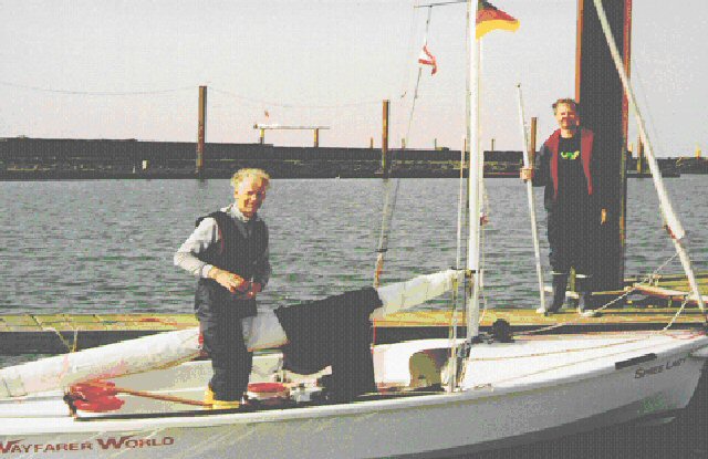
Making the final preparations aboard Spree Lady for our departure to Esbjerg.
Cedric standing on the jetty with the spinnaker pole.  Photo taken by the crew of the yacht Dolphin.  

We were taken by surprise a little while later when the crew emerged form the hatchway. We immediately apologised for draping our clothes over every convenient rail on their yacht, but they didn't mind at all, and invited us aboard to share a coffee as they were most interested in our venture. Their hospitality couldn’t have been greater, and it was difficult to make excuses to leave, but we needed to finish packing the boat and get away on the last of the ebb. We finally exchanged addresses and made a hasty exit from the cabin.


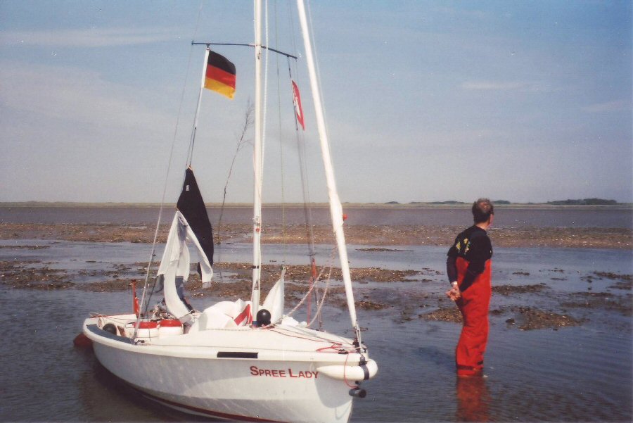
Stopped in the shallow channel on the fast receding tide, with Cedric looking north to the island of Borkum. 
 My wet sailing gear has been hung up to dry in the sun, after getting a foot stuck in the mud and falling in the water!

The harbourmaster gave Cedric a forecast of fine weather for the next few days, with a southwesterly breeze, F.3 to 4. It looked as though favourable winds would be with us for the last and longest leg of our trip. It seemed almost too good to be true - and it was! The harbourmaster had also mentioned that there was a channel around the back of Borkum deep enough for our shallow draft boat to use to get out to sea, thereby shortening our journey a little. Unfortunately we hadn't gone a mile or so before the channel became so shallow in the dropping tide, that it was impossible to go further (photo above). We turned round and pulled the boat back through the ever receding water in the channel, and were eventually able to use the outboard to motor sail past the marina we had left an hour and a half earlier.


Sailing out to sea past the most popular beach on Borkum, where many holiday makers were taking advantage
of the fine sunny weather. The fine sandy beach continued as a shallow spit for more than a mile out to sea.

We then had to fight our way out of the Ems estuary against a strong flood tide, and even though we hugged the shoreline as close as possible, it cost us a further hour. The decision to try to cut a relatively short distance off our trip had in fact cost us 2½ hours. It wasn’t the best of starts for the most demanding leg of our trip to Denmark. It was nearly 1400 before we finally cleared the shallow water off Borkum and set a course for Esbjerg. I had planned to cross the two shipping lanes in daylight, and was now concerned that we might not clear the second lane before it got dark, so I was disappointed we had lost so much time, even after seeking local knowledge. We were, however, in good spirits. The weather was fine and sunny, and with a F.4 wind, we had up a full main and genoa. In fact, the conditions couldn’t have been more ideal, and we had high hopes of a relatively easy sail to Esbjerg.

By 1550 we had passed the Juister Riff N. cardinal mark, which confirmed our position, as well as the GPS reading of an average speed of 4 knots. With a steady wind, and the sea still relatively calm, we decided to try all three sails by putting up the asymmetric spinnaker as well. This gave us the best sail of the whole trip, and at one point we seemed to be planing along with the crest of a small wave for nearly a full minute - planing is always the most exhilarating part of any sail, but this one continued for far longer than I had ever experienced either previously, or since. Our speed improved to 5 knots, so that an hour later, we had covered the 5 n.m. to the TG7  cardinal buoy, marking the start of the shipping lane.
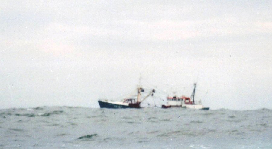
 
    Passing a fishing vessel near the first shipping lane,
with the weather starting to deteriorate, and the sea beginning to get up.

...
SHIPPING
 
Whilst it might be thought that needing to change course to avoid shipping might be a relatively isolated occurrence, it has happened  on each of my North Sea Wayfarer trips so far (five to date). On our first trip to Ostend in a Wayfarer, we were escorted by two cruisers, who decided we should hold our course when a ship was seen in the distance. We had no option but to stay with them. It was the most frightening experience of my life as the ship sailed towards us, particularly as we were the nearest to the ship’s approach! There was a period of many minutes when it seemed certain the ship would run us all down, though it did eventually pass comfortably behind us. I determined then, never to sail in front of any ship again, if there was any doubt, and to always go behind. 


WEATHER FORECASTS
 
We carried a small radio to receive the BBC shipping forecast, but generally relied upon local sources - particularly the harbour master or information office when staying in yacht harbours or marinas. In this instance, the local forecast had been seriously inaccurate and we should not have missed the BBC shipping forecast for such a major trip.
   
There was no doubt that the conditions out at sea in the German Bight that night were severe, though because of the complete darkness, it was impossible to judge just how strong the winds were. Whilst I never considered that we were in any great danger, I  certainly wouldn’t have ventured out of the harbour, had I known that gale force winds were imminent. 
   
It was only when we received a letter from the skipper of the yacht we had met in Borkum Marina that we fully appreciated just how bad the conditions had been during the night. He reported that the wind had been so strong, that coupled with the noise of torrential rain, it had been impossible for them to sleep on their boat, moored safely in the marina!
.
It was at this point that our earlier hopes of an easy sail to Esbjerg began to prove far too optimistic. A period of heavy rain started as soon as we had entered the shipping lane and taken the asymmetric spinnaker down. No ships were to be seen ahead as we had made our approach, but five appeared on the horizon as we began our crossing. The first went by in front of us, but the next two had to be negotiated by steering their course until they had passed. We encountered no more ships before passing buoy TG 12, marking the end of the first shipping lane.

At 1920, I got the chart out in the evening drizzle to check on the second shipping lane. With a further 18 n.m. to go, I calculated it would take another 3 to 4 hours, and would certainly be dark before we had finished crossing the lane. However, we had no option but to press on. The wind gradually increased until we needed to reef the main. I used the spinnaker pole to push out the genoa on the other side, and we creamed along at 6 to 7 knots (from to the GPS reading). We were most conscious of safety however, and made sure we always felt in full control of the boat.

Around 2130, we approached the second shipping lane. By now, the wind and sea had increased sufficiently for it be prudent to reduce sail again. I furled the genoa and sailed on reefed main only, to give us better manoeuverability in the event of meeting any ships ahead. As we had entered the lane, there had been just sufficient light to scan the horizon to be sure there were no ships ahead. We presumed that this lane was for deeper draught vessels and therefore less busy. It was with some relief that we saw the lights of only one vessel in the distance behind us whilst crossing this shipping lane. The wind had remained steady during the crossing, but after taking another GPS reading to confirm that we were out of the shipping lane, it increased considerably again, perhaps to F.7 or more. It's difficult to tell when it's too dark to see anything! For safety, I decided to take the reefed main down and sail under jib only during the night. Cedric was happy for me to take the first rest, even though he had been on the helm for much of the day.

...  

Saturday 18th July

An hour later, at 0030, Cedric woke me for my turn at the helm. It was not only raining heavily again, but from the howl of the wind through the rigging, it was obvious that its strength had increased to a full gale. It had become quite cold, so we were both thankful we had on plenty of thermal layers to keep us warm. I immediately became rather concerned about a constant, quick flashing white light, appearing to be in the near distance to the east. In the appalling conditions and rather tired state, I didn't feel at all like getting out the GPS, almanac and chart to check what it might be. After keeping a close watch on the light's unchanging position for some 30 minutes, I decided to change the jib onto the other tack, and steer a more northerly course to give us plenty of sea room. It seemed wise to assume the light represented danger, and to steer away from it for safety. (I have since learned that it was almost certainly a submarine on the surface - not a primary teaching point on navigation courses)!

Once we had changed our course, it was reassuring to find the light disappearing into the distance. By 0215, Cedric had woken, and taken over the helm again. The driving rain had stopped and I took this opportunity to get another GPS reading to plot on the chart. This confirmed our position as being on course. Satisfied that everything was O.K, I settled down on the floor with my back leaning against the foredeck for another nap. I was awoken abruptly an hour later by a wave breaking over the boat which completely drenched me. It certainly wasn’t the most pleasant way to be woken for my turn on the helm again, with water pouring down my neck and front, but very effective. I was now both wet and cold, and had no further inclination to sleep whatsoever! Fortunately, the World design performed brilliantly in this situation, with a boat-full of water draining through the transom flaps in just a few minutes. It was a relief that we had been sailing on jib only, for capsizing at night didn’t really bear thinking about. We had both been wearing harnesses, and everything in the boat had been secured with a line. We should have been able to right it again without any great difficulty, even in the darkness and very rough seas. But even so, it would have made the remainder of the trip extremely unpleasant.

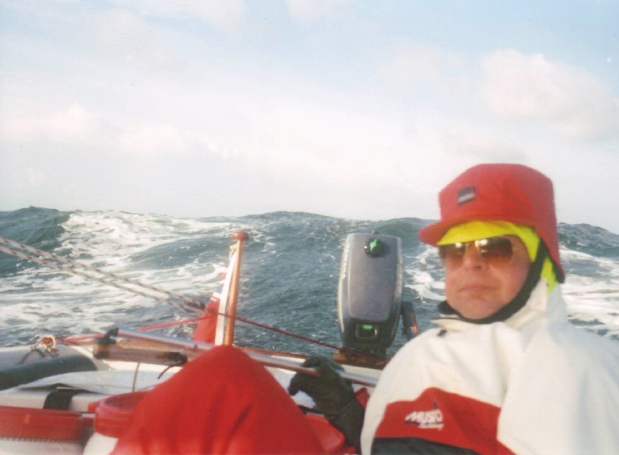
At 0520, with the morning light clearing away the last remnants of darkness, I took another GPS reading and noted it on the chart. The wind had abated, and the sea calmed down just a little, so we decided to put up the reefed main. Whilst standing to do so, a wave lifted the front of the boat, causing me to fall backwards awkwardly and smash the back of my head against the end of the tiller. Thankfully I was wearing my canoe crash hat, though I still felt much of the impact through it. If I hadn’t been wearing the crash hat, I would have suffered an extremely serious - perhaps even fatal - injury. This was not my opinion, but that of Cedric, who is also a G.P.


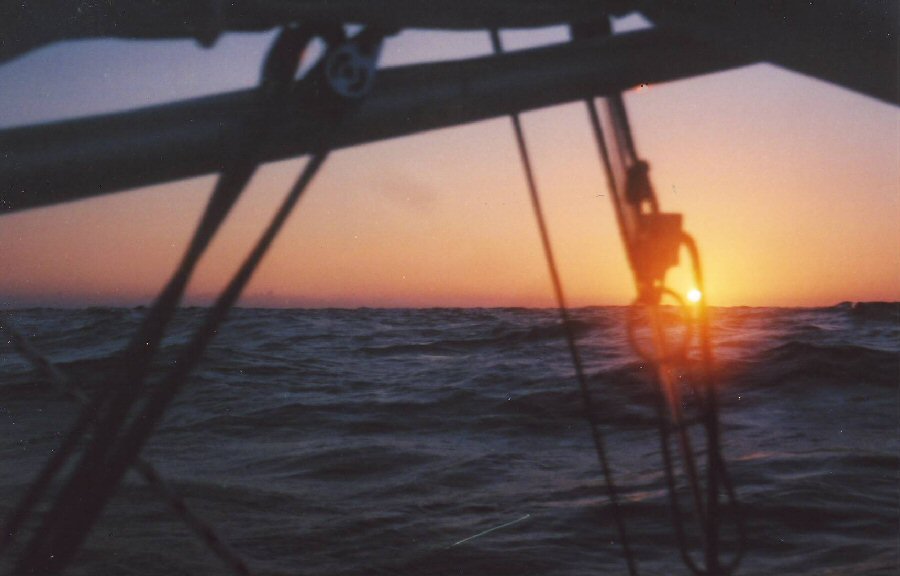
The very early dawn, with the sun emerging on the distant horizon and providing me
with some welcome warmth on the final day of our eventful crossing to Esbjerg.

An hour or so later the sun made a most welcome appearance on the horizon, and for the first time since getting drenched by the wave earlier in the night, I began to feel some warmth seeping through my body. This made life much more comfortable, for although I had put on extra clothing to prevent myself becoming hypothermic after my soaking, this had not seemed to increase my body temperature much. The wind gradually strengthened as the morning wore on, so that by 0800, we were "motoring" along on a broad reach with a reefed main and jib, in seas that were once again becoming quite big. The GPS gave us readings of up to 8 knots, when we were planing down waves, and generally indicated an average speed of 6 knots, though at this point, we both still felt we were sailing well within a comfortable safety factor and in full control of the boat.

Half an hour later, we were getting near to the point of being overpowered for an open sea cruise, and we discussed whether it would be prudent to take down the main. Cedric may well have been distracted by our discussion, because almost immediately, Spree Lady broached. We were only just able to prevent a capsize, as water poured in over one side. Once we were back upright, I wasted no time taking down the reefed main. It was to be the last time, we would have the main up until we reached Esbjerg. I changed the jib over to the genoa, which I pushed out with the spinnaker pole, and checked our speed on the GPS, which still showed we were making 5 to 6 knots.


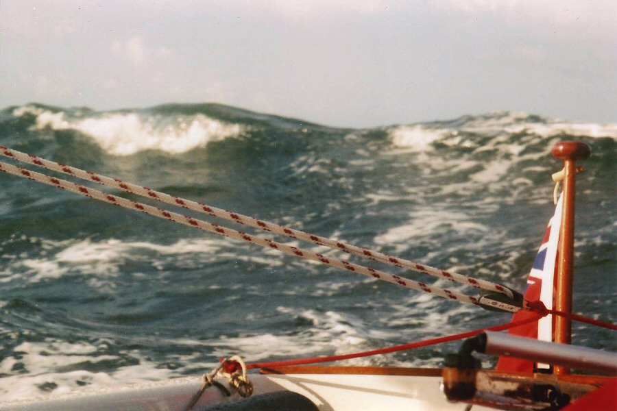
This was the start of the big seas we were to encounter on the final leg of our trip to Esbjerg.
Standing up to take the photo would have given a better perspective of the two sets of waves in the picture - sitting down to take it was a lot safer! The end of the tiller that made contact with my head is visible in the bottom right corner.


Cedric planing down the face of the wave behind - which was much larger than it looks from the photo! The track of the boat is marked by the dark, flat water, with the foam being scattered on either side. Still with the reefed mainsail up at this point.

By 0900 we could see the long coastline of the island of Westerland. It was certainly most reassuring to be in sight of land again, but we were less happy at seeing the changing cloud formations above us, which gave an indication that further bad weather was on its way. We decided to steer a course that put us a little closer to land, so that if we couldn’t reach Esbjerg by 1800, then a nearer port or safe haven would be sought. I took another GPS reading and calculated that if we continued at our present speed, we should be able to make Esbjerg before our proposed deadline.


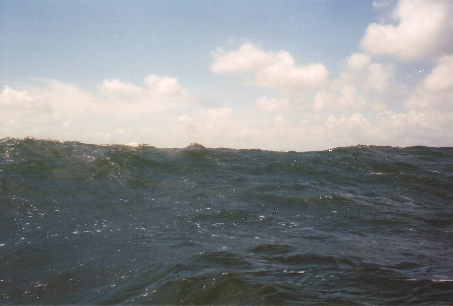
This series of photos, taken during the day, illustrate how the conditions deteriorated,
with big seas and the dark threatening clouds building in the sky.


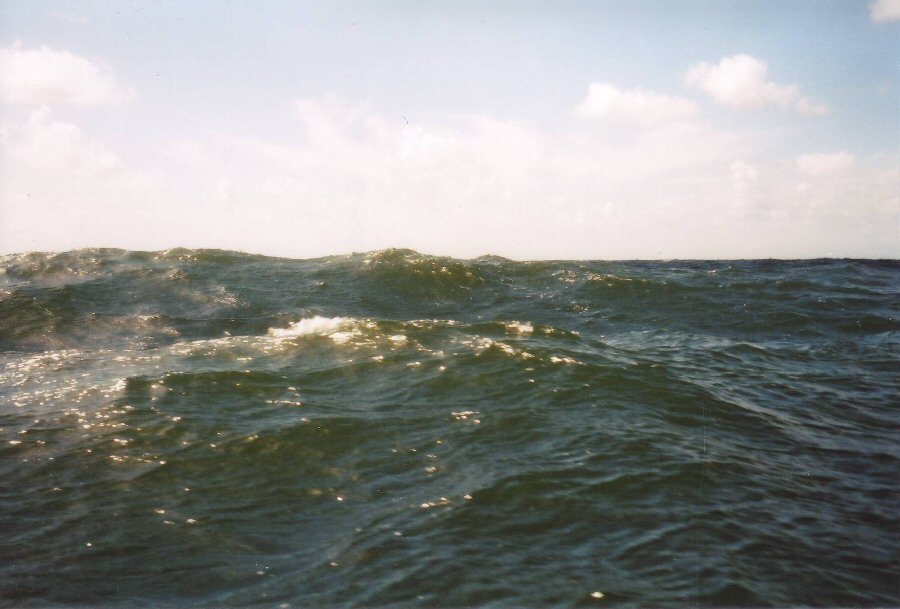
As the waves weren’t actually breaking, we were able to ride over them with ease
and they gave us no real cause for concern. 


 The waves were the biggest I have ever experienced. I estimated them - hopefully without any
exaggeration - to be around 30 to 40 ft from trough to peak.


When I checked the GPS again at 1000, it came up with the information that the satellite receiver had failed! I was relieved that I had been plotting the previous GPS positions on the chart, but had now got so used to relying on the device for our position, that I was almost aghast at the prospect of having to go back to the dead reckoning system I had used on previous trips.

At midday I tried the GPS again, which this time came up with a bearing, much to my relief. The wind had increased in strength, probably to F.8 or more - it was difficult to judge in such strong winds and big seas. It certainly seemed far wilder than a previous F.8 I had sailed in, though this may well have been due to being out in such exposed conditions, rather than the wind strength.

It seemed prudent to change the genoa down to a jib. Although the seas were the biggest I have ever experienced in a Wayfarer, the sailing was surprisingly comfortable, and we never felt in any sort of danger. Had the wind increased still further, I was confident that we could have furled the wet jib down to only a ‘pocket handkerchief’ size, and run to a port of safety, only 10 n.m. to the east of us
   
Cedric settled down for a sleep, having been on the helm for most of the morning. He awoke an hour later - probably more through discomfort than anything else - and looked around to see the tall white chimney at Esbjerg in the distance. I hadn’t noticed it myself, being more concerned with helming through the waves and reading the compass bearing, but we were stirred with a great feeling of elation at the sight of our destination, albeit there were still another 20 n.m. to go.


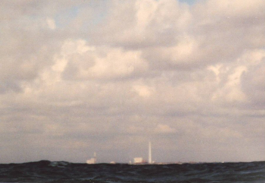
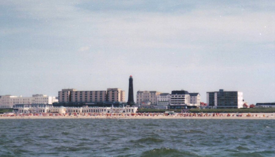
Esbjerg's distinctive industrial chimney landmark was visible from over 20 n.m. off the coast.

There was little opportunity, or apparent need to take another bearing for the next few hours as we surfed along towards Esbjerg. The speed of around 6 knots under jib only was quite amazing. It was only as we approached a landfall off the island of Fanø that I appreciated that getting nearer the coast as a useful insurance against the weather deteriorating would now be to our disadvantage.

The strong onshore winds had created an area of turbulent water far further out from the shallows off Fanø than I had expected from my large scale chart. I altered course to get as far to seaward as possible of the rough water ahead, but with only the jib up, it was too late to avoid it altogether. For the next 15 minutes or so, Spree Lady was tossed about in the short steep waves like an item of clothing in a washing machine. We were more than a little relieved to reach the safety of the deep water channel into Esbjerg. Approaching the end of the channel, between Fanø and the mainland, we turned north to make for the Ho Bugt Sailing Club, where one of my Danish Wayfarer friends, Jens Konge Rasmussen had recommended we land.


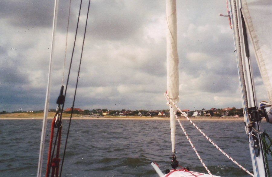
Approaching the Ho Bugt Sailing Club to the north of Esbjerg, which has its own large fleet of Wayfarers. 
The asymmetric pole is still out the front of the boat,
unable to be pulled back through all the gear stored under the foredeck.


We finally reached the Club slipway at 1740, just 20 minutes before our target time of 1800, and only 4 hours before yet another severe gale blew through. Next morning it was still blowing far more ferociously than we had experienced the previous day, and looking out at the waves crashing onto the sandbank just offshore, we were certainly grateful to be safe on land, and not
out at sea.

There had been little chance to celebrate the success of our trip the previous evening, but during the next morning there had been more time to contemplate our achievement. We had covered the 140 n.m. from Borkum in 28 hours at an average speed of 5 knots, mostly under jib or genoa only. We had arrived somewhat tired, hungry, wet, bumsore, and with my fingers swollen from salt water getting into cuts and grazes. But we had made it, and the exhilaration of completing the trip more than made up for the various discomforts.


Spree Lady lying at anchor, with all our gear removed, before we used a spare trolley at the Club to bring her ashore.
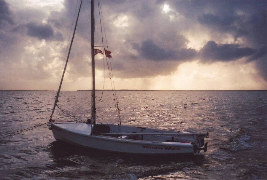
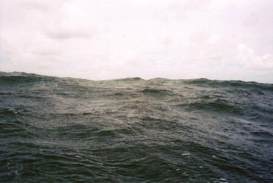
The threatening black skies warn of the severe gale about to blow
through.
...
LESSONS LEARNED
 
1. Though we sought the Borkum harbourmaster’s local knowledge and advice, I should not have tried to get round the southern end of Borkum at low tide. Even if it had proved feasible, the short amount of time it would have saved was never worth the chance of failing.
 
2. I should have involved Cedric much more with the navigation and passage planning for this part of the trip, rather than taking sole responsibility. Had I not been wearing a canoe crash hat when I fell backwards, my injuries would have resulted at the very least, in a severe concussion. It is certain that I would have been totally incapable of assisting Cedric, who had no navigation experience, in a totally unknown and hostile environment.
 
3. I had purchased six Admiralty charts, both large and small scale to cover the areas I planned to sail, giving sufficient detail to cover possible safe havens should this become necessary. The only area I didn’t have in detail was the approach into Esbjerg, the detailed coastal chart of this region finishing just a few degrees below the port. In an effort to economise, I relied on my large scale chart for entry into Esbjerg, together with detailed sketches of the estuary sent to me by my Danish colleague. Trying to save a few pounds proved a false economy, and meant that my approach to Esbjerg was closer to the island of Fanø than would probably have been the case had I had a more detailed chart. This resulted in a much rougher and potentially dangerous finish to our passage.
 
4. I should have purchased a radio with built in tape recorder to ensure I didn’t miss the BBC shipping forecasts, rather than relying solely on being provided with weather forecasts from local sources. I would certainly not have set out from Borkum had I known we would encounter such extreme conditions.
...
Addendum
   
We didn’t ask the harbourmaster at Borkum to inform the local Coastguard of our crossing to Esbjerg because of language problems. It is possible however, that we were reported to the Coastguard by one of the ships we had altered course to avoid, since the sight of an open dinghy so far out to sea must have been extremely unusual, and probably even alarming, for the ship's officers. When we were discussing the incident on a visit to my local Coastguard station, they felt that this was likely to have happened, and that the German Coastguard, knowing that gales were imminent, had put out an alert to all shipping in the area to report any sighting of us, giving our reported position and bearing.
   
A submarine exercise area is marked on the charts of the German Bight between the two shipping lanes, and a submarine in the area may have picked up the Coastguard alert and used it as an exercise to find and track us. It seems the only explanation as to why we were shadowed so closely for some considerable time, until I altered course to indicate that I felt they were a danger to us. The submarine appeared to recognise this and also altered course, as their light diverged from us more quickly than could be accounted for by only my own slight change of course. The light then continued to follow us from a further distance through the remaining darkness of night, until it was lost in the early morning light. It is now apparent that I should have made more effort to notify the German Coastguard of our proposed crossing.
 
Ralph Roberts  W9885  Spree Lady
...
Postscript

Bob and Clare also successfully reached Rantzausminde, though they had a narrow escape from disaster when a cruiser giving them a tow through the Kiel canal, stopped to refuel. A manoeuvering coaster just missed their boat, and smashed into, and crushed, the three yachts moored immediately behind them. It would have been a bitter irony for them, had they been a little further back, to have survived crossing the North Sea, only to come to grief in what one would regard as a much safer stretch of water. They managed to sail around 30 n.m. most days, and were holed up for only one day in Wangerooge with the bad weather we experienced.


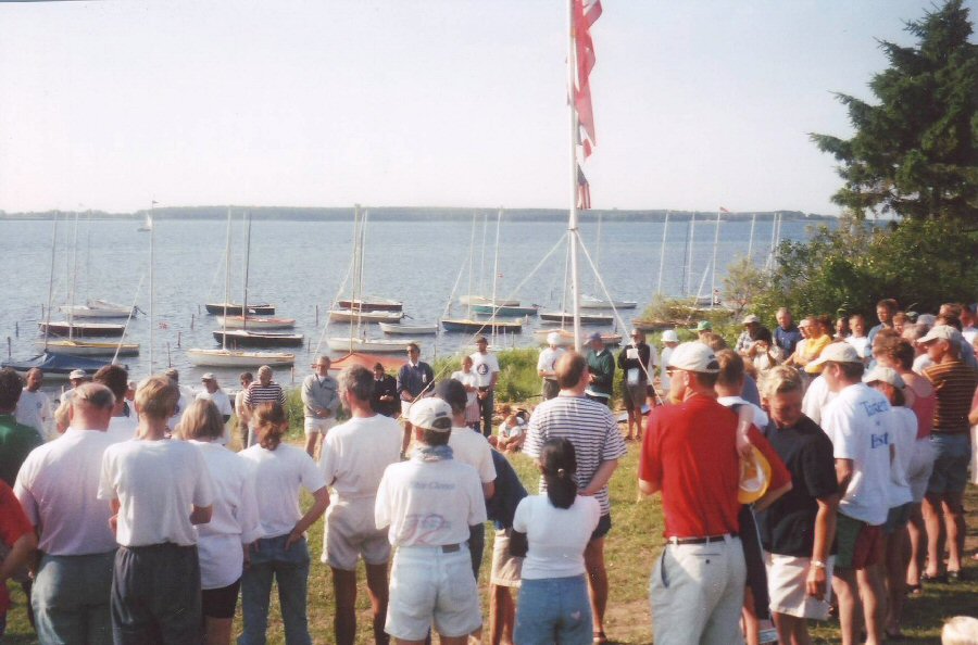
Crews from the International gathering of over 70 Wayfarers being briefed for the day’s proposed sail. 
    It is the most perfect location for sailing that I have had the good fortune to visit.
Nowhere else could you simply walk only 50 to 100 m. from your tent or camper to your boat, and set off to sail.


The Wayfarers are moored to stakes in the sandy bay, which is shallow enough to permit walking out to the boats.
The sailing in the area couldn’t be more ideal, with many islands and places of interest to visit.
With a choice of many directions in which to sail, most trips can be organised by sailing on an easy reach.

The Harlands were given a rapturous reception on their arrival at the Rally by the 70 plus Wayfarers and families from various parts of Europe and North America, who were attending the event. A great evening was enjoyed, including singing around a campfire to the Danish Wayfarer Stompers group of musicians, before they set off the next morning to tow their Wayfarer back to the ferry terminal.


return to this log's index
Cruise Logs index