|
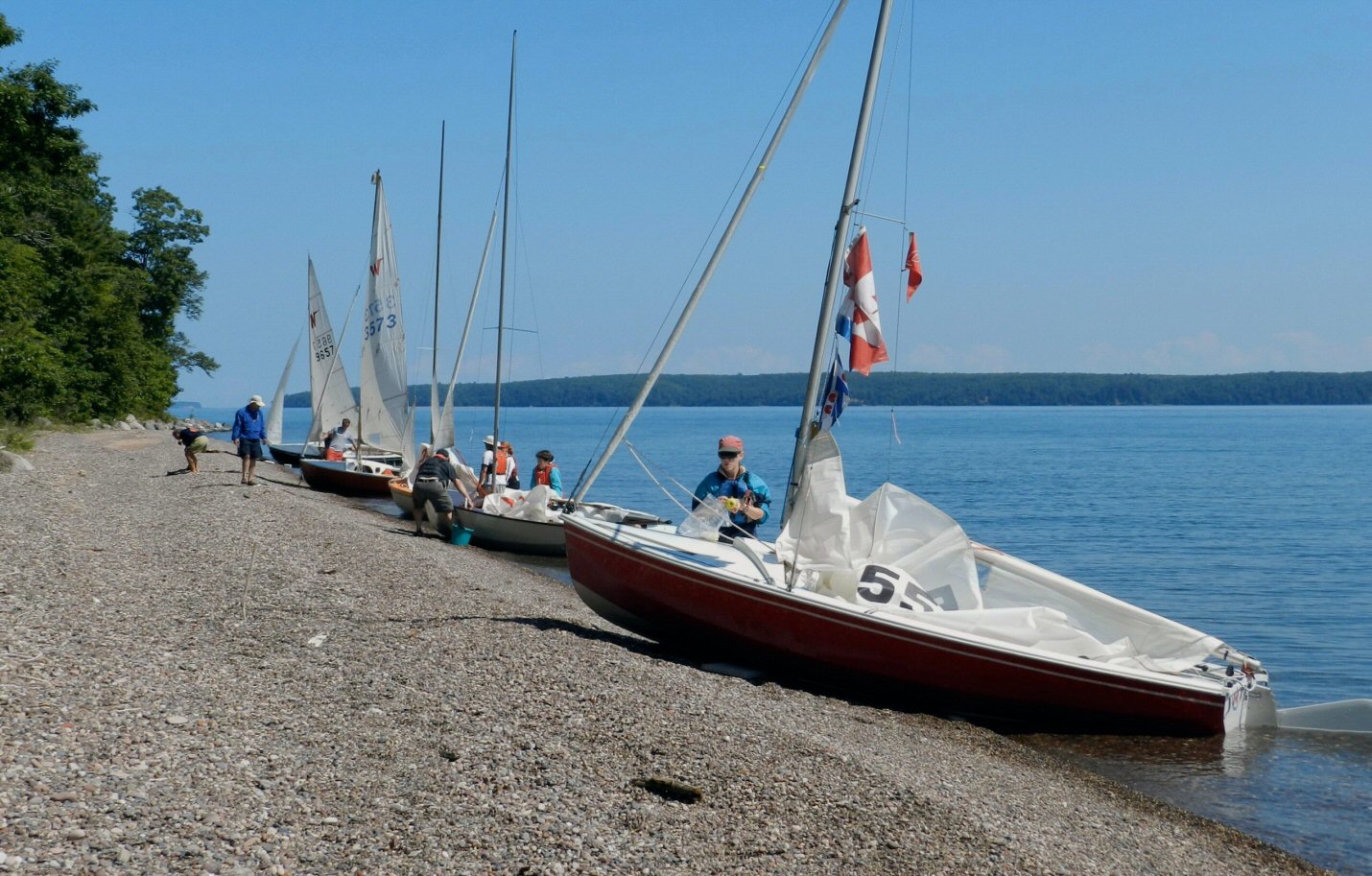
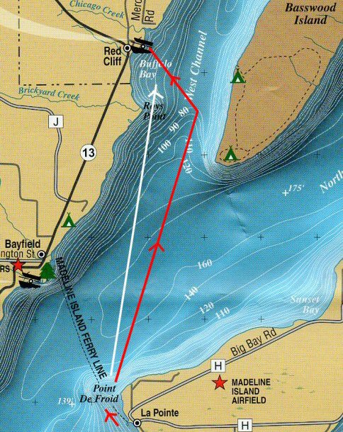
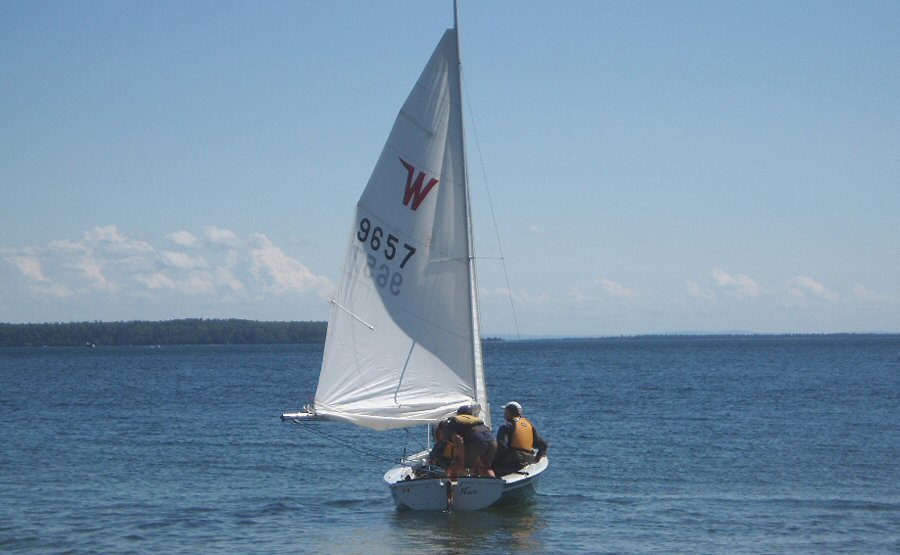
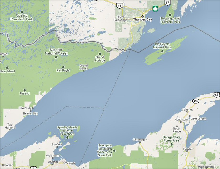
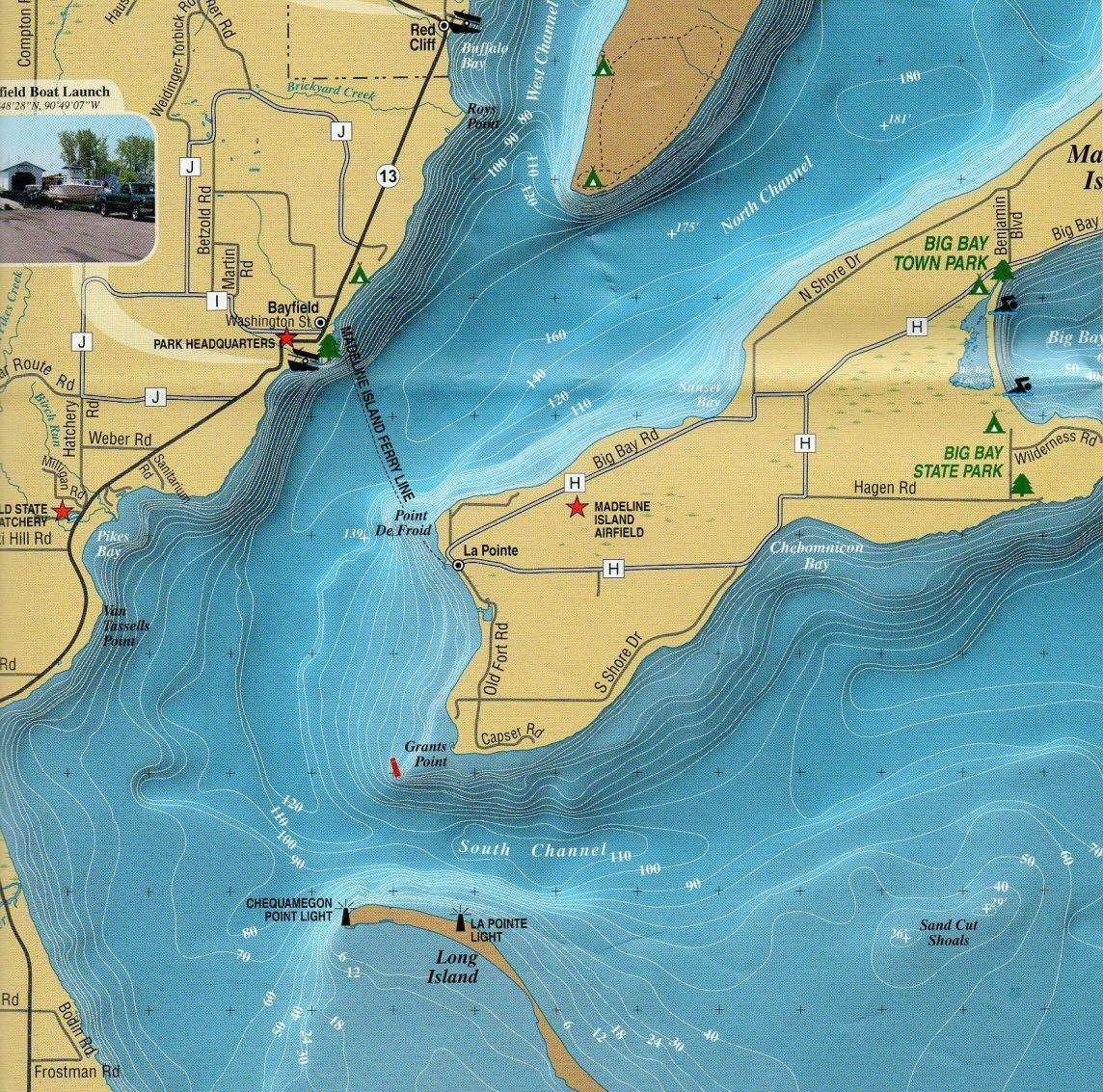
West Meets East The Rally and Beyond August 2011 Apostle Islands National Lakeshore, Lake
Superior |
|
|
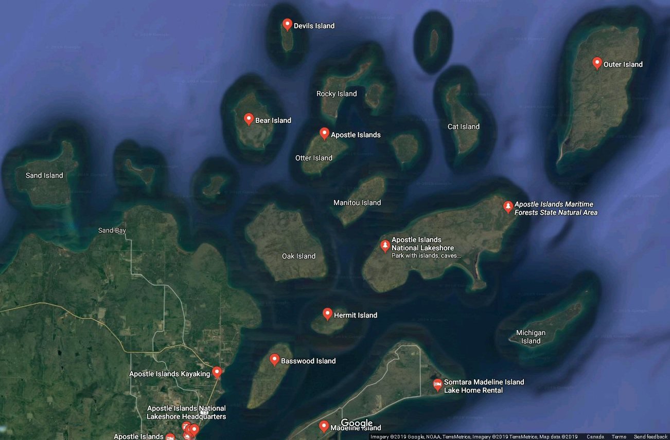
Twenty-two
jewels
strung out into Lake Superior, right off the north end
of Wisconsin's
Bayfield Peninsula. These gems' northern shores tend
to be steep cliffs, some
of which are cut into wonderful sea caves, and
seamounts. Their southern tips
are often graced by sandy spits. Both of these shoal
out -sometimes a mile or
more. The mainland shore is dotted with nine marinas
providing access or a safe
harbor as needed. The Apostles themselves provide many
good anchorages, though
none of these are fully protected. A major wind shift
can turn a protected
anchorage into a dangerous lee shore. So be ready to
up anchor even at night.
Fortunately this usually means a short move to a new
protected shore, either
around to the lee of the island, or upwind to the next
island. So chart out
your options and route before turning in. For
our
2011 West Meets East Wayfarer Rally, we looked
to a local tribe, the
Red Cliff Band of Chippewas. They own and personally
run their Legendary Waters
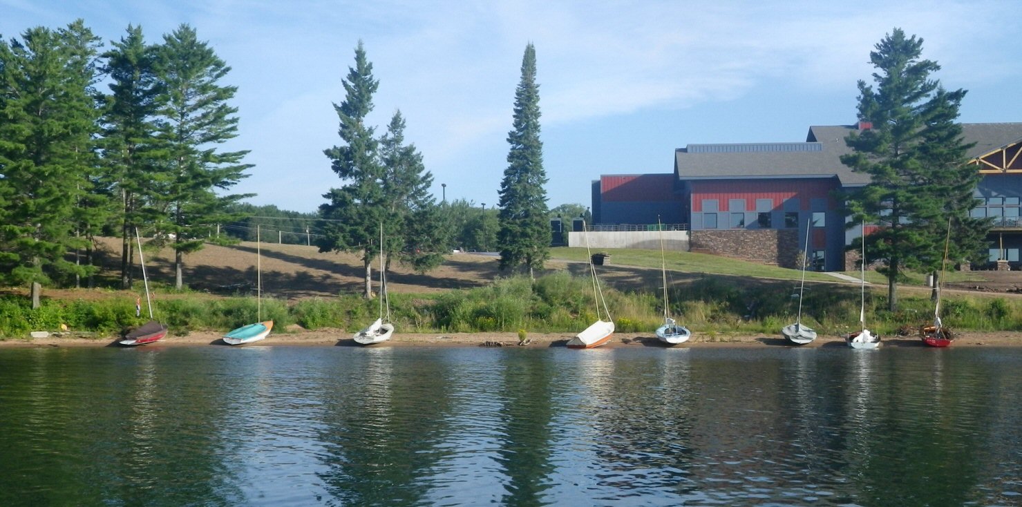
casino, hotel, campground, and marina. Our small boats
could be drawn up on
shore, or anchor off for free. Proper marina berths
are also available. The Red
Cliff Band has provided a central location for rallies
of small catamarans and
pocket cruisers for years. Recently the Red Cliff
Tribe has developed a new
swimming area limiting beaching and anchoring off.
When planning to go, you will
be wise to check on what services are currently
available.
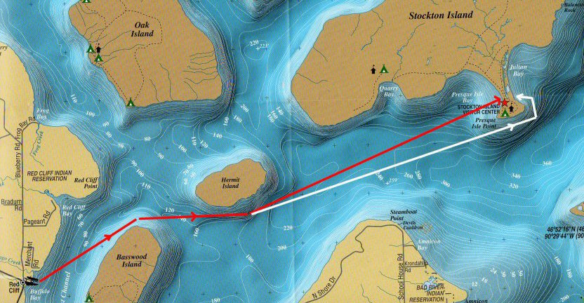
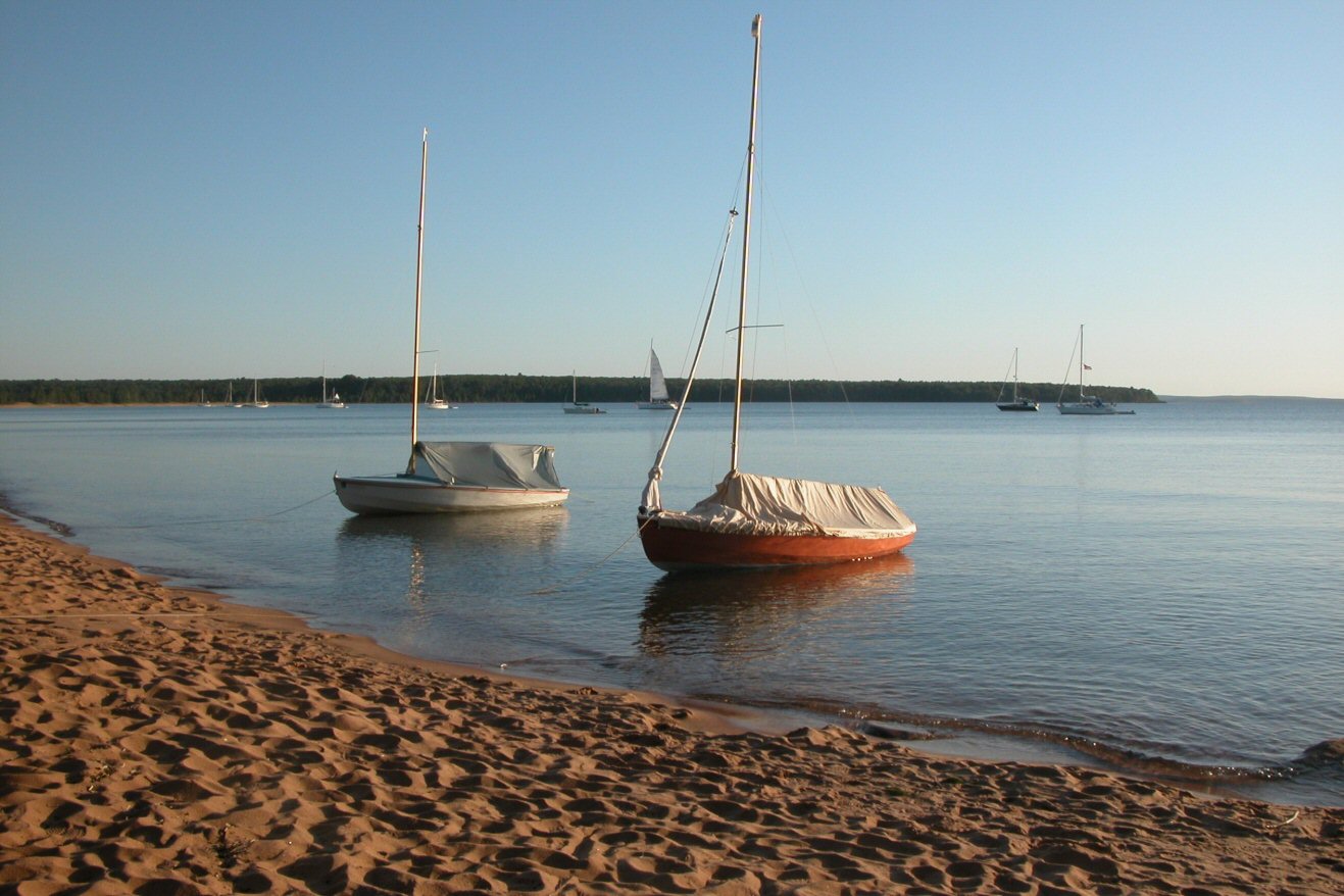
Sunday
we
sailed from Red Cliff for the north end of Bassswood
in perfect sunshine and
light NW winds. Rounding Basswood, we skirted its
north end, ducking behind
Honeymoon Sea Stack (above) that
we
had missed the first day. A lone pine tree crowns its
lovely undercut sides,
and you could see large slabs of rock through six feet
of crystal clear water.
For
lunch
we pulled up on a small sand and gravel beach on
Hermit Island’s south
end. The small pebbles and sand lodged themselves into
a couple centerboard
cases creating a nasty challenge to get the
centerboard down again. My
centerboard gaskets protected me very nicely. The sail
back was in diminishing
winds. As we were rounding the southern tip of Hermit
Island, the wind died
leading to mile-long rowing race. Alex being young and
strong, tried to row
fast and hard, but soon left the task to this slow old
man who just kept us
moving along at a steady pace toward the front of the
parade. Then a soft wind
brought the slow boats right back into Red Cliff
Harbor. After dinner and a
nice group meet and greet, the Kolstoes left me to
visit family in Minnesota.
Monday
brought
my new crew, Andy Ivancic, and decent winds that died
as we were making
our way SE to Madeline Island (above
left). The wind came back, keeping us company as
we headed to the small
settlement of La Pointe, on Madeline's SW end. For
about a mile, we sailed
alongside a commercial fisherman returning with the
day’s catch and a great
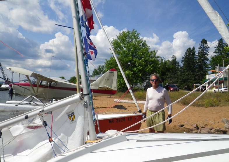
following of sea gulls. We pulled up on a little
beach with lots of interesting
cottages, boats, and a seaplane (above
right) that proceeded to take off. Up the
main street we found food, ice
cream, and a museum. Don't miss a drink at the
Burned Down Bar
(below right), which is not just its
name, but a description of this unique
establishment! The sailing was just
right both ways.
Tuesday
we
were off to Oak Island with stiff winds to keep things
moving. We visited
the south end sand spit where another centerboard got
stuck with sand. Once
again I was glad my boat, Ält Bäd,
had a centerboard gasket. They do work. That evening
we went to a local member's
spacious rented house for a genteel party. It sure
beat huddling in our tents
in what turned out to be a cool and rainy evening.
For
the
next day, Wednesday, half the fleet planned on an
overnight trip, and the
rest would head to town for some tourism. In the
morning we woke to find 12 to
15 knots of SW wind, so everyone started out reefed.
The wind picked up to 20
knots and soon four-foot waves were rolling us
downwind toward Stockton Island.
As the wind increased and our nerves settled, joyous
surfing took us over nine
knots, about double our hull speed. We even had some
sunshine. Ält
Bäd was the designated shepherd
boat, we took a couple of broad reaches to slow our
forward progress and stay
to the back of the fleet. This gave us more confidence
in handling the waves,
when previously anything but straight downwind had
looked like it might be too
much for us. Andy and I were working well together
which added to the fun. With
our
increasing confidence, Andy and I started tacking
upwind, then sailing any
point that seemed fun and kept us near the back of the
fleet. This helped as we
had gotten too far downwind to be useful if anything
were to happen with the
last boat, Orange
Top. Having
installed a makeshift reefing system, Orange
Top could not easily gybe, and they were having
to tack if they wanted to
change tacks. This was a bit slow.
On
Stockton,
the dock and south shore collected a few of us while
the rest rounded
Presque Isle Point, an island that a tombolo
(sandbar/dune) now connects to Stockton,
making it a peninsula. There we went inside the larger
cruisers anchored off
the mile-long beach, the islands’ longest.
By
anchoring
out, we avoided booking a camp site, fees and bears.
But note that
the Lakeshore rules require an anchor light regardless
of boat size or distance
from shore. Despite the large number of boats there
was plenty of room for
quiet, meditative walks in nature. Both groups walked
across the tombolo to
socialize and check out the other half of the fleet.
The following day’s return trip was a
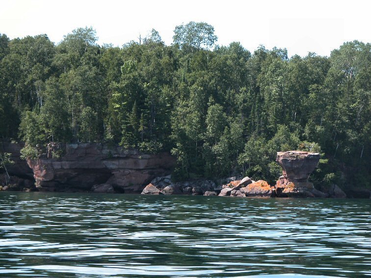
pleasant sightseeing
excursion along faceted sandstone cliffs. Think
Chicago brownstones; they were
all quarried out of the center of these islands. The
islands have provided
food, shelter, and work to Chippewas, fur traders,
loggers, quarrymen, and
fisherman. Today you can visit staffed historic fish
camps, quarries, and
lighthouses. If you apply early enough, you might
score a week or a month of
being island-bound as a docent/caretaker of a
lighthouse. Soon our pleasant
trip turned into a slow drift with boats taking
largely divergent courses. In
the end, the wind filled in enough so we did not have
to row miles and miles
home.
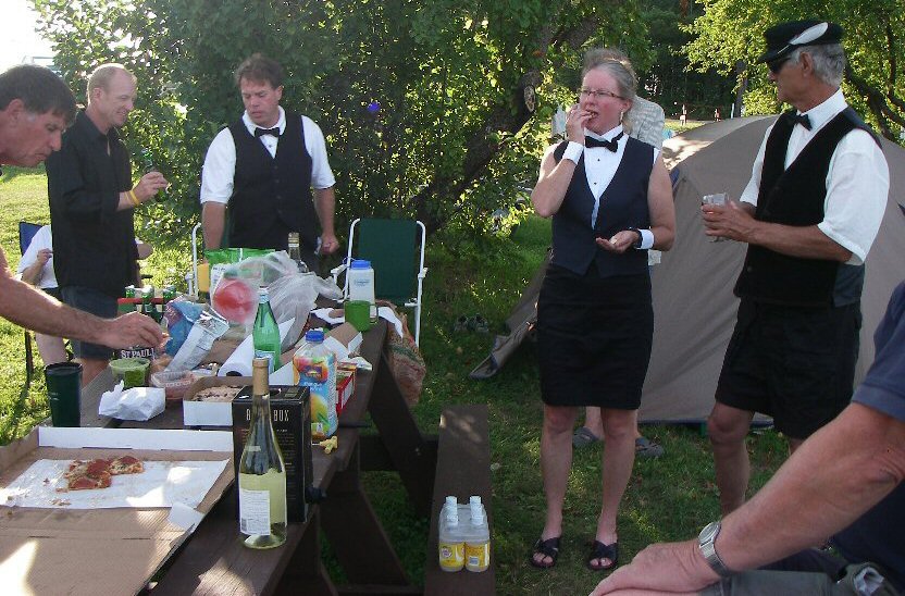 That evening we had our Black Tie Party,
a Wayfarer tradition. Our
idea of black tie varies and brings out our creative
nature as we enjoy this
evening of pleasant talk and bonding.
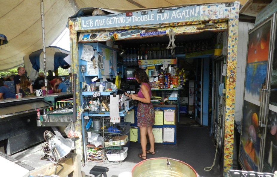
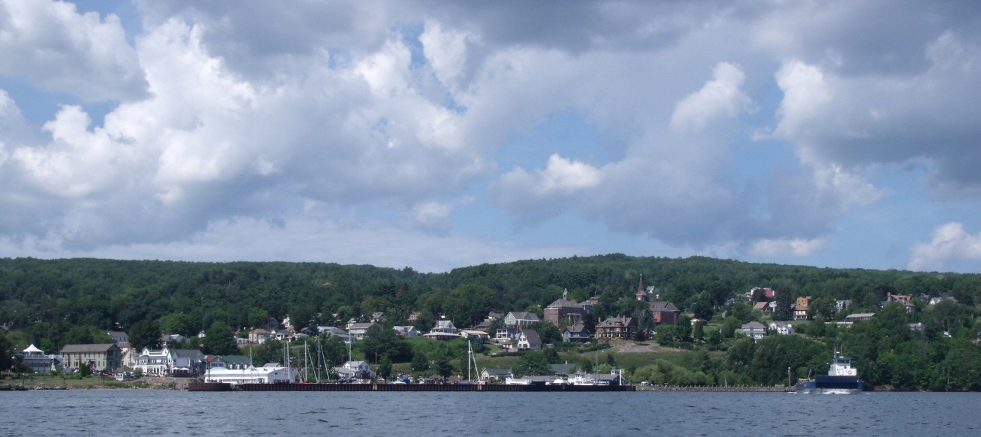
Bayfield, the best Midwest Town, anchors
the area providing most
supplies you'll need from beer to a haul-out. The
restaurants run the gamut and
you should enjoy them all. A member of our group had
access to a nice condo on
the waterfront where we could gather and enjoy each
other's company. That
Friday afternoon we ate fresh whitefish. Wow! There is
nothing like it, unless
it's fresh wild blueberry pie from The
Candy Shoppe. Just call a day ahead to order
your pie. I stuck Andy with
the bill for that pie. After I found out how much it
was, I felt a bit bad.
The
sail home was delightful. In the evening we emptied
our
coolers and had our traditional Left Over Supper
Party. The
end of a perfect day, and a perfect week
with fellow Wayfarers. You can find another report on
the our week at http://www.wayfarer-canada.org/nostalgia/events/event.nostalgia_M-Z/Rally.reports/2011Apostle/2011Apostles_reportAAb.html |
|
Sailing and
Cruising
Solo August 20 through 28. 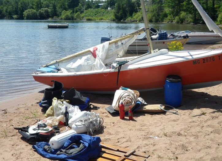
After
the first week, the
other Wayfarers left, and I headed out on my own. But
not till I got a call
from my 97-year-old mom. She said she was in the
hospital with an irregular
heart beat, but it wasn't that bad, and I should go
sailing. (She lived to be 102.)
The lovely day soon turned gray with winds pushing
over twenty knots. Near
Madeline Island, I hove to and reefed as the wind
became brisker. While
reefing, I stayed to the windward side to keep the
boat from heeling
uncomfortably in the short sharp waves. A Capri 16
altered course to sail close
by and asked if I needed help. My response was
friendly and negative. The top
portion of the Capri's main sail was pumping back and
forth threatening a gibe.
Made me wonder who was going to need help first.
 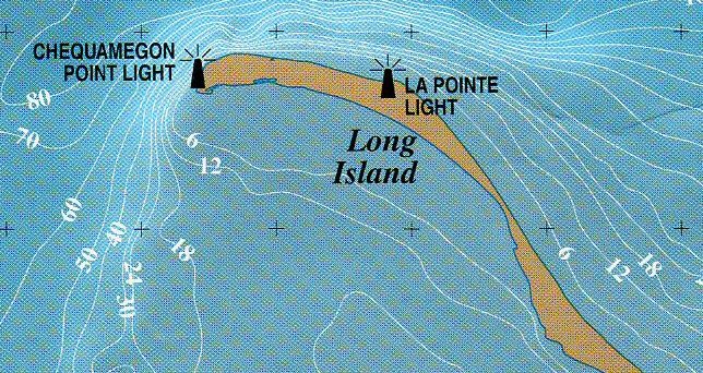 Once reefed, I headed on to Long Island
or was it Long Peninsula?
It's one or the other depending on water levels.
Here the shores are protected
bird nesting areas, so care must be taken. With the
strong northerly wind, my
planned anchorage looked uncomfortable for a boat
with a tent up and was
perhaps in the birds' area. So I rounded up and
repassed the Chequamegon Point
Light (it was moving quite slowly!). A southerly
direction would have taken me
into Chequamegon Bay and several all weather
marinas. But north took me to a
large cove off Madeline Island State Park, very much
like Stockton’s. It
protected me perfectly. 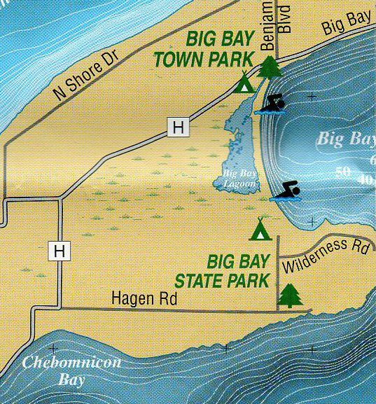  Once all these Islands were named after
states, but today only
Michigan Island has a state name, and that's not the
one it started out with.
The Lighthouse on Michigan gives a good excuse to
dock, walk up and enjoy a
tour with the docent. Fresnel lenses ((below
right) are always a delight to view, better
than any diamond. 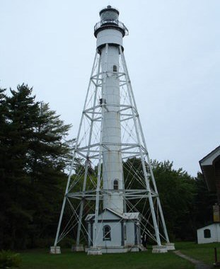 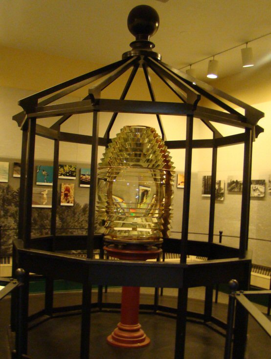 I cast off from Michigan and sailed
away to another uneventful
night on Stockton. The Island is a lot more fun than
I make it sound. It's just
that sunny pleasant days do not stick in my head as
well as the more challenging
parts of the trip. This time I was anchored very
close to the SE end of the
long beach, very Bahamas like, or what I think the
Bahamas are like. This time
I got the outer and inner anchor system going
perfectly, so that I could pull
myself into the beach or back out. I had a lovely
walk along that very long
sandy shore, and a perfect night's sleep.  Monday morning, one of the
least visited Islands
beckoned me, the aptly named Outer Island. The short
curved beach on the north
end (an exception to the usual pattern) offers
protection just from the
southerly winds. But that's where I spent the night,
and this was a high risk
choice, so think long and hard before you follow my
wake. Upon arriving at the
north end I set up my three pulley system with my
stretchy anchor rode to pull Ält Bäd up
the beach and questionable
safety. Outer Island is considered a bit crowded
with even just one person
around, but surprisingly, someone else was already
there. It was Craig
Blacklock, known locally as Mr. Superior for his
photographic work and public defense
of the waters. He has kayaked a mere 3,000 miles
along Superior shores. When
Craig saw me he come down to the beach jumped to,
grabbed the rode and gave
some mighty heaves. He soon gave up. I went back to
leaning my weight into the
line and inching her up the beach. Speed just gets
sucked into my systems
stretch. Long steady pulls work well if slowly. That
beach was a lot steeper
than I had planned on.  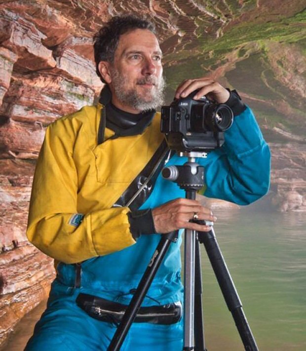 It's a nice walk up the
stairs to the top of the
bluff. In the center of the stairway are the old
iron rails for the lighthouse
supply cart. Don't know if it is still used. There I
joined Craig who was
taking pictures of the Lighthouse every 15 minutes,
all day long. He had two or
three spots and he would walk a circuit taking
pictures from each on a
schedule. A “you-hoo?” sounded from the forest,
which Craig answered. A young
lady asked if she could come out, or would they be
interfering with the
picture? Craig (above) said
“No
problem” and two college girls walked out of the
woods. They had spent two
weeks surveying the fauna of the island. The leader
was very quiet and the
other seemed glad to have someone to talk to, and
she did not stop. Next the
park boat showed up and now we had 3 boats and 5
people, it was a mob scene!
They left and it was back to Craig and me. We were
soon joined by thousands of
dragonflies, and as the sun set the air became thick
with fireflies. What a
lovely day! Made the mistake of
sleeping in the boat. The angle up
the beach made it rather uncomfortable, a tent on
land would have been nicer.
That night anchoring out would also have worked,
with the lack of wind.
Thursday morning I took a slow walk past the
Lighthouse outhouse, and on to the
creek. Turned around there as I was barefoot and
wearing shorts, and the woods
on the other side could have been full of Lyme
ticks, or not. The sand flies hatched out that
morning, they and lime ticks run
in cycles. We were lucky to have missed the flies
during the Rally week. You
need to have protective clothing as they will win
the long war. Except for the
biting flies, the morning started blissfully enough.
After starting out with
full sail I quickly turned back for shelter from the
wind while putting in a
reef. As the wind picked up and the waves rolled I
saw a large rock that looked
to be eight feet down at most, yet at this spot the
water is 200 feet deep!
That optical illusion was truly amazing! While the
boat was moving smartly
along I did not seem to make much progress, between
tacking and killing flies.
Good thing Uncle Al suggested having a fly swatter
aboard. A thunderstorm slid
from the SW over the land, then came out over the
islands. This is unusual and
the storm was not forecast to be over the islands. I
was soon counting seconds
between lighting strikes and thunder claps which did
not get closer than about
eight miles. The worst of the storm stayed about a
mile away on the south end
of Outer and Cat Islands. This is why “Mother
Superior” must be respected and
NOAA listened to regularly. Not all storms give long
warning, and can be
unpredictable in their course as I found out! The
water is deep and cold. The
surface water warms up to 50°F plus in August, but a
strong wind can quickly
mix up the water layers putting an end to that.
Drysuits are a good idea for
small boats and solo sailors. I wished I had one.
Count on quick response only
from yourself and crew. People do die in these
waters and quickly. Yet this is
the most protected area in the tricky waters of
Superior and with proper
caution you will enjoy these glorious cruising
grounds. You can also read my
article published in Small Craft Adviser here: http://www.wayfarer-international.org/WIC/Cruise.Logs/2011Passage_in_a_Storm/2011Passage.html Much later, by email, Craig informed me
that the wind and waves
were so wild seven miles south that he could not
safely land on the sandy
southern tip of Outer Island (below).
He paddled back north a bit along the eastern and
protected side of Outer
Island. There he climbed up on a rocky shelf and
pulled his kayak up after himself.
Craig got under an overhanging rock just in time to
avoid the rain. 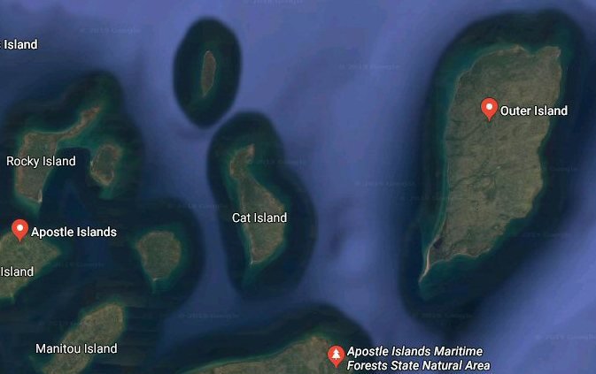 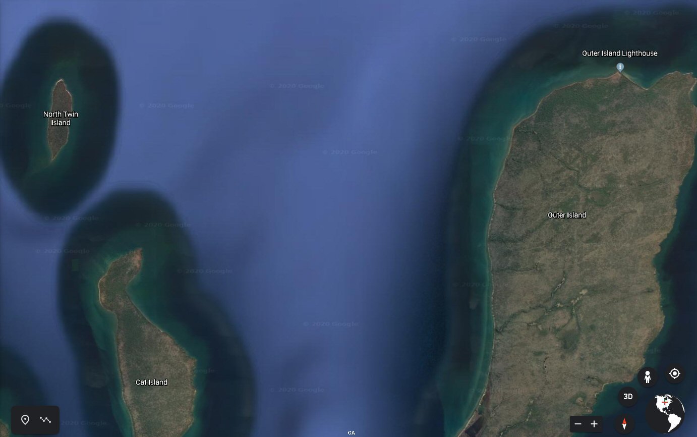 It's a nice walk up the
stairs to the top of the
bluff. In the center of the stairway are the old
iron rails for the lighthouse
supply cart. Don't know if it is still used. There I
joined Craig who was
taking pictures of the Lighthouse every 15 minutes,
all day long. He had two or
three spots and he would walk a circuit taking
pictures from each on a
schedule. A “you-hoo?” sounded from the forest,
which Craig answered. A young
lady asked if she could come out, or would they be
interfering with the
picture? Craig (left) said
“No
problem” and two college girls walked out of the
woods. They had spent two
weeks surveying the fauna of the island. The leader
was very quiet and the
other seemed glad to have someone to talk to, and
she did not stop. Next the
park boat showed up and now we had 3 boats and 5
people, it was a mob scene!
They left and it was back to Craig and me. We were
soon joined by thousands of
dragonflies, and as the sun set the air became thick
with fireflies. What a
lovely day! Made the mistake of
sleeping in the boat. The angle up
the beach made it rather uncomfortable, a tent on
land would have been nicer.
That night anchoring out would also have worked,
with the lack of wind.
Thursday morning I took a slow walk past the
Lighthouse outhouse, and on to the
creek. Turned around there as I was barefoot and
wearing shorts, and the woods
on the other side could have been full of Lyme
ticks, or not. The sand flies hatched out that
morning, they and lime ticks run
in cycles. We were lucky to have missed the flies
during the Rally week. You
need to have protective clothing as they will win
the long war. Except for the
biting flies, the morning started blissfully enough.
After starting out with
full sail I quickly turned back for shelter from the
wind while putting in a
reef. As the wind picked up and the waves rolled I
saw a large rock that looked
to be eight feet down at most, yet at this spot the
water is 200 feet deep!
That optical illusion was truly amazing! While the
boat was moving smartly
along I did not seem to make much progress, between
tacking and killing flies.
Good thing Uncle Al suggested having a fly swatter
aboard. A thunderstorm slid
from the SW over the land, then came out over the
islands. This is unusual and
the storm was not forecast to be over the islands. I
was soon counting seconds
between lighting strikes and thunder claps which did
not get closer than about
eight miles. The worst of the storm stayed about a
mile away on the south end
of Outer and Cat Islands. This is why “Mother
Superior” must be respected and
NOAA listened to regularly. Not all storms give long
warning, and can be
unpredictable in their course as I found out! The
water is deep and cold. The
surface water warms up to 50°F plus in August, but a
strong wind can quickly
mix up the water layers putting an end to that. Dry
suits are a good idea for
small boats and solo sailors. I wished I had one.
Count on quick response only
from yourself and crew. People do die in these
waters and quickly. Yet this is
the most protected area in the tricky waters of
Superior and with proper
caution you will enjoy these glorious cruising
grounds. You can also read my
article published in Small Craft Adviser
here: http://www.wayfarer-international.org/WIC/Cruise.Logs/2011Passage_in_a_Storm/2011Passage.html Much later, by email, Craig informed me
that the wind and waves
were so wild seven miles south that he could not
safely land on the sandy
southern tip of Outer Island (below).
He paddled back north a bit along the eastern and
protected side of Outer
Island. There he climbed up on a rocky shelf and
pulled his kayak up after himself.
Craig got under an overhanging rock just in time to
avoid the rain. 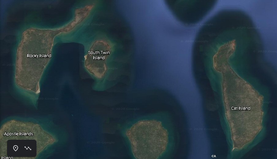 Thursday brought an end to flies and
the sail was easy and
relaxed. So much so I only recall arriving at Rocky
Island's east dock which
held a park boat and a 30-ft power yacht with a
friendly captain. The gentle
south wind gave me a beam reach around the
30-footer, and I slipped right
between the two boats and just kissed the dock. The
captain's name was Anderson
and he grabbed my line and complimented me on my
docking skills, which really
did look good. He had a large campfire ready to go
in the evening. The park
boat pilot came back and before he cast off, we
chatted about the weirdness of
the last thunderstorm and how far it had come out. After eating and getting ready for the
night, I joined Capt.
Anderson who burned way too much wood in that
bonfire and we talked. Turned out
he had taught and worked with Craig Blacklock whom I
had just meet on Outer
Island. Anderson's wife was extremely shy and I
never even saw her. Her husband
said she knew every orchid patch in the Islands. Thursday morning, a life-long resident
dropped by, offering a
guided tour of the island. He had been born two
miles east on South Twin
Island, and moved across the ice one winter's day
carried in his mother arms.
He was proud of the fishing tradition of the
islands, and the old sandstone
quarry in the center of the Rocky Island. 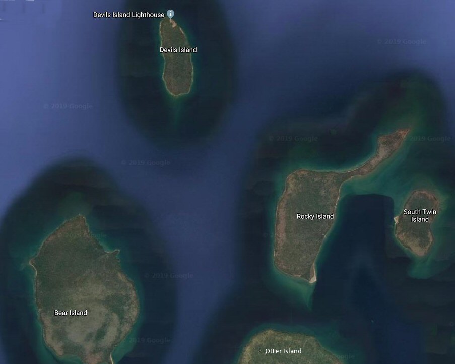 Devils Island was saved for last. The
winds were forecast to be up
to 20 mph in the morning and lowering in the
afternoon. First I tried going
around the north end of Rocky Island but away from
the lee of the land the
water looked like the inside of a washing machine
and a little scary. If only I
had checked my proper chart instead of the National
Geographic waterproof map,
the reason would have been clear, shallow water! The
waves had been happily
rolling over Lake Superior's 200 feet deep bottom
and now were getting all
lumpy about having only twenty - sixteen feet to
play in. Sailing straight out
into Lake Superior away from all land and shallow
bottoms, would have given me
normal rolling waves and the same wind. But in my
ignorance and uncertainty, I
turned around and had a quick romp clockwise around
Rocky. In fact, on the
sheltered east side, the wind was good with regular
waves, and soon I was
hiking out and up on a plane. I swear the waves
would explode half-way up to the
spreaders when I hit them just right. Good thing I
had my dry-top on. It was
crazy sailing this way on Lake Superior. My euphoria
and amazement were
intense. Coming around the south end of Rocky, I
dropped down towards Otter
Island to take a look, but rules to protect the
Otters who live there kept me
from getting too close. The wind had dropped a
little and with deep water under
me the waves were quite regular. My run north to
Devils Island was brisk but
very controlled. Devils' Harbor is only suitable for
smaller shallow draft
cruisers, larger boats must anchor out for the day.
The entrance is guarded by
a large flat wandering rock, which the winter ice
leaves where it wants come
spring. My usual practice of pulling out or
anchoring in the shallows was stopped
by evenly distributed rocks along the shore. So I
resorted to the harbor wall
which can only hold a couple boats and does not give
great protection from
strong waves in my opinion. A 20-footer, captained
by Wayne, soon joined me,
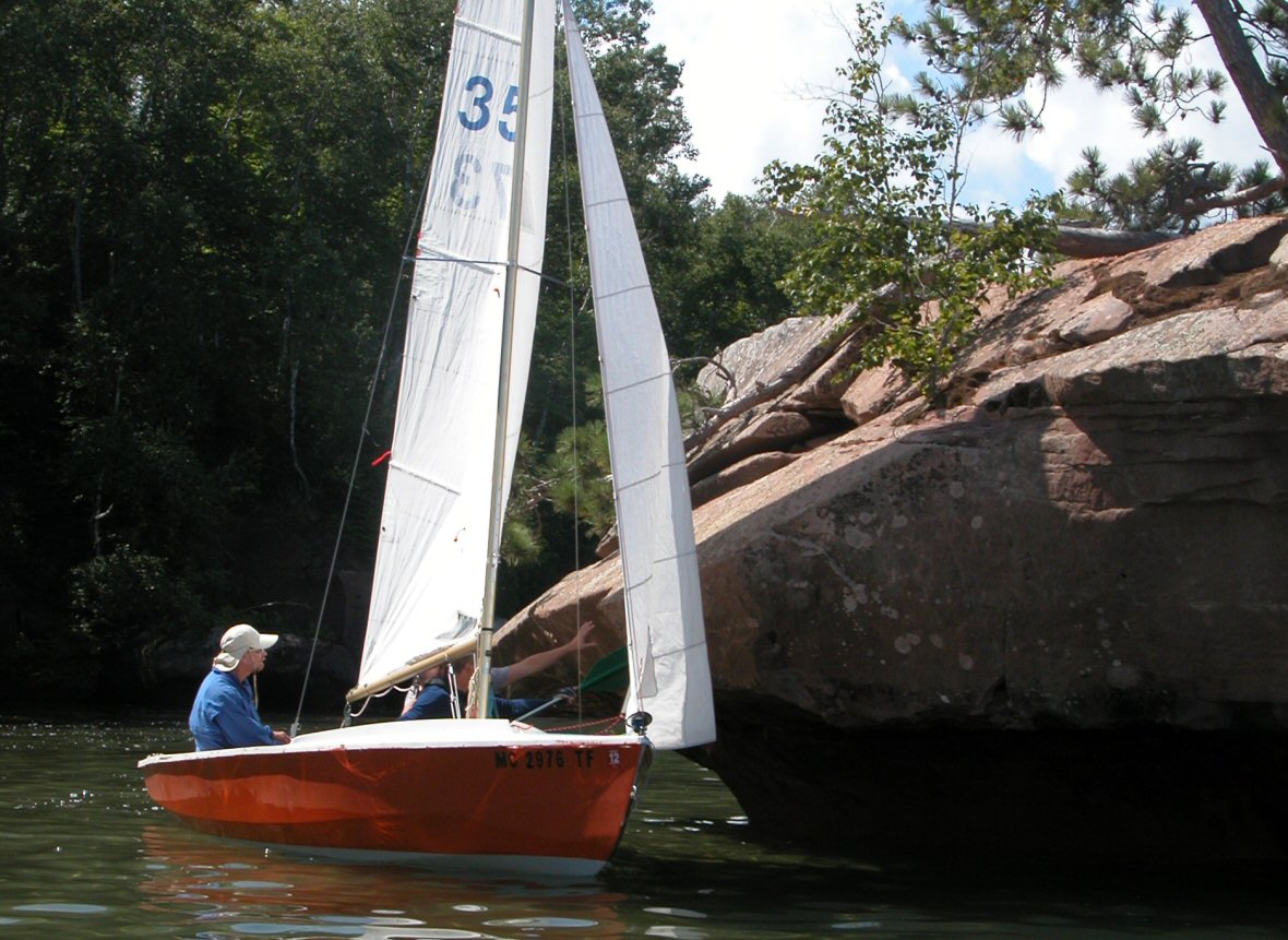
amazed at my having come in under sail. We ate
supper together by the old
boathouse. 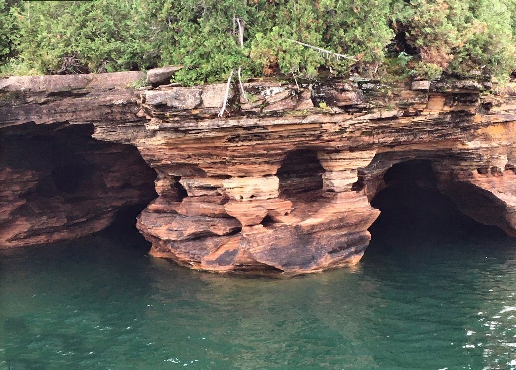 Saturday morning an early walk up the
mile-long abandoned tramway
used by small hand push carts was rewarded by
another lighthouse and guided
tour. Near the lighthouse there are blow holes a
hundred feet back from the
cliff edge. Huge waves pressurize the caves shooting
water sky high, only to
suck some leaves back down. But not today. Looking
over the edge I saw only Craig
Blacklock kayaking amongst the caves catching the
early morning light with his
camera. I had not seen him since the storm and he
was too far down to talk to.
There were no other boats in sight. 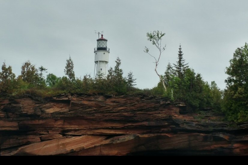 Once I had walked back to the harbor,
it was time to pack up. In
total calm I rowed to the north end of the island.
Wayne and crew used kayaks
they had brought on their sailboat, to access the
shallow water surrounding the
island. They soon passed Ält Bäd and
me.
The whole west coast of Devils Island is littered
with beautiful small sea
caves, pools, moss, and flowers. As I rounding the
north end of Devils, a dozen
or more boats came into view. All out enjoying the
unusual calm and the flat
water which allowed people to kayak and wade in the
big sea caves. Looking
north eight miles out you could see large ore
carriers going about their
business. 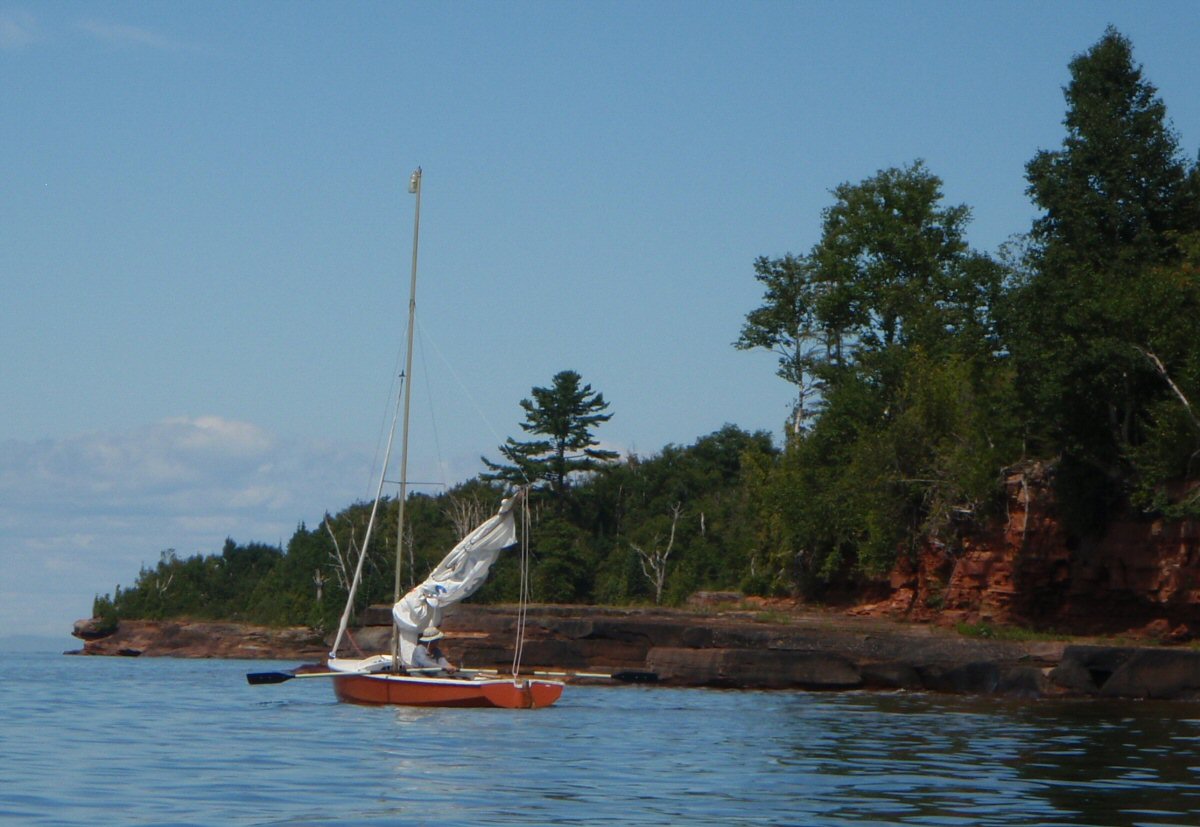 By 3:00 PM it was time to head home. It
was my birthday, and time
to indulge myself. I was going to sail 22 miles back
to Red Cliff. My course
lay SE between Rocky and Otter Island and down to
Manitou Island. What little
wind there was, died at sunset just as Oak Island
come into view. Slowly lights
became visible from the boats anchored off the NW
end of Oak. I “just” kept
sailing SE at less than a knot parallel and close to
Manitou Island's west
side. I actually spotted the reef on its SW corner,
it had a small marker and
weak battery operated light, and my course was
outside the reef area anyway. I
was trying to avoid using the GPS on my first night
sail. Had not been sure I
could navigate with just starlight, but with big
black islands for markers it
wasn't too hard. By 1:55 AM Sunday, I pulled up onto
the beach below the
Casino, dragged the sail over myself and went to
sleep till sun-up. As I
crawled out in the morning, there was this lovely
older lady, who peppered me
with questions and treated me like some kind of
hero. Turned out she once owned
a Cape Dory Typhoon, and was now sailing a Laser in
these waters which takes a
special toughness. Looking back, my two weeks of sailing
covered a lot interesting
places, yet left a lot to go back for. After
retrieving the car and trailer
from the off-site parking, I packed up. Before
heading home, I stopped by the
National Lakeshore Service Office and paid for my
unplanned camping on land. Resources:
|