| Lake
Superior
By Dick Harrington |
|
It must have been approaching 10 PM. However, being so far north vestiges of the earlier brilliant sunset still lingered as faint traces of pink and purple splashes in the western sky. The colors were one minute visible, and then suddenly not, as the sky would blacken when we passed beneath the shadow of a mountain. I was tired and so was Rob. Almost as if on auto pilot, the Chevy Blazer with Blue Mist in tow wended through the steep curves and across high two lane bridges spanning steep sided ravines and gorges. After two fantastic weeks of cruising Lake Superior we were, sadly, on our way back home. Yet Lake Superior was not yet through with us.
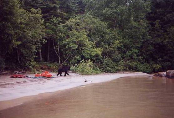
The one thing most impressive of the multitude of emotions that this land evokes is its massive proportions and untamed state. This is a world where everything is big, from the granite rock forming the mountains that ring the lake’s shores, to the endless forest of tall slender spruce trees and silver bark birch. Here also, if one makes the effort, can be witnessed the less familiar and larger species of forest and aquatic life—otter, beaver, moose, elk, caribou and black bear, to mention a few. After an exhausting day of traveling, whether on the water or on the trail, the mournful evening lullaby of the northern loon quickly lulls one into a deep peaceful sleep. It is truly a land of vast unspoiled wilderness. Lakes, large and small, and countless rivers and streams greet the eye at every turn in the road. However, all is not heavenly. Biting insects are voluminous and aggressive, requiring extra protection in the way of clothing and repellent. Nowhere is the ground flat. The forest floor is dense with thick undergrowth, and towns and settlements are few and widely separated. Yet, in a world where most things are now artificial and plastic, where standing in a line waiting your turn and paying for recreation or entertainment is the norm, this is one of a few places remaining where one can experience the unspoiled magnificence of God’s creation. It’s free of charge, but not free from effort. Lake Superior presents a challenge to anyone attempting to traverse its waters or shores.
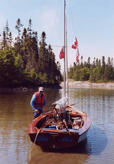
It had been a long day for me. I had taken the greyhound from Rossport back to the Michipicoten River to pick up the car and trailer, and then had driven back to rejoin Rob at the boat. Finally around 9 PM we were on the road. Route 17, the Canadian Transcontinental Highway, for the most part is just two lanes wide along the rugged north shore of Lake Superior. At frequent intervals a familiar yellow and black road sign would light up in the auto’s headlights—a picture of a large moose with the words “night danger” inscribe below, to be repeated in French as well. The area is very remote and we had the road to ourselves, other than for an occasional passing of an oncoming car or truck. Then in the blink of an eye there it was. The gray mass of a very huge animal was standing in the road directly in front of the Blazer. Somehow, miraculously pulling myself together, I hit the brakes and swerved simultaneously. There was a loud bang and the crashing of shattered glass. “God, I think you broke its neck!” Robin exclaimed. Shaking, I brought the Blazer to a halt, still in the center of the highway. After making a quick inspection of the car and boat, we ran back to check on the poor moose. The moose was gone and surprisingly there was only minor damage to the car. The boat suffered no more than a small spattering of blood. What good fortune! We had managed to no more than sideswipe the creature. I’m certain, other than for a nasty bruise or two, the moose survived. Later one of the locals told us that she never drives at night.
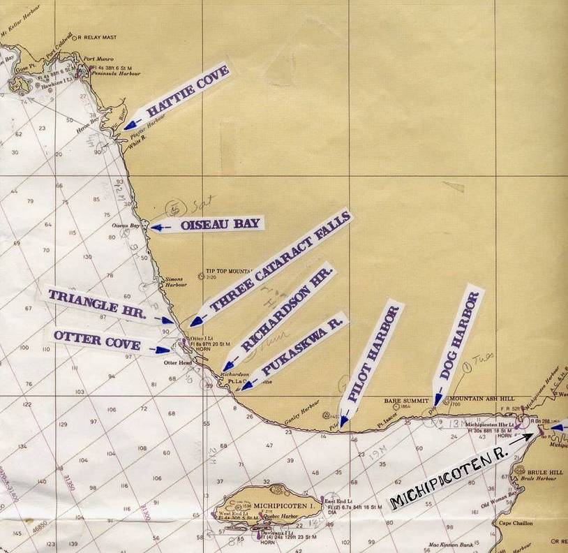
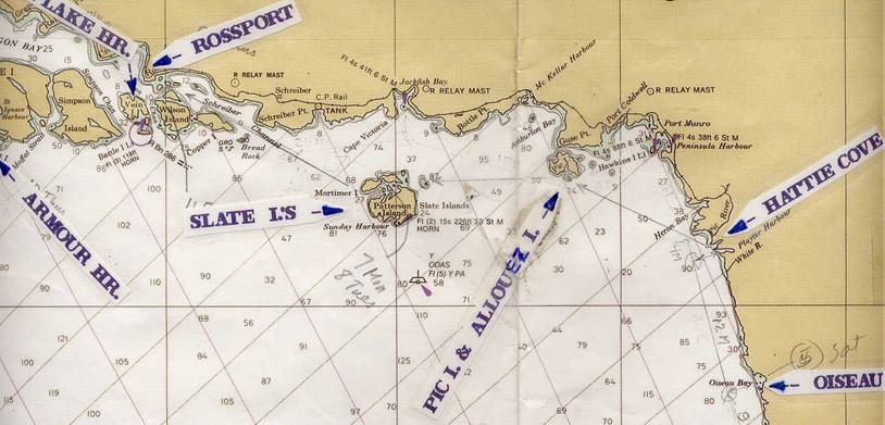
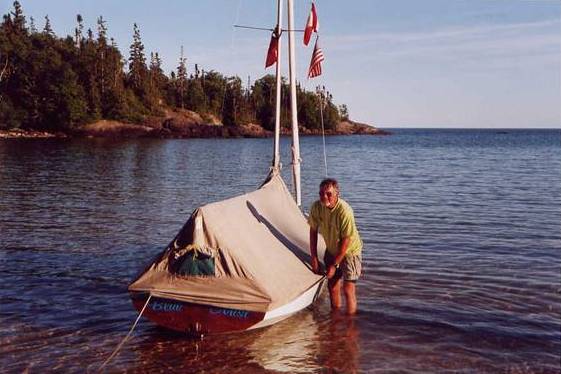
This past July Rob Golding, an experienced Wayfarer sailor from Farnham, England joined me for an extended cruise on Lake Superior. After driving north from Toronto for a day and a half we at last arrived at the Michipicoten River, our point of departure. From there we sailed north and west along the lake’s most remote and unspoiled northeast coast, camping ashore and sleeping in the boat as we went. The first part of our travels took us through the vast wilderness of Pukaskwa National Park. Following that we made an open sea crossing westward to the tiny island of Allouez and then another crossing to the beautiful Slate Islands. We ended our cruise by pulling out at the picturesque town of Rossport. The total trip of approximately 150 nautical miles, as the crow flies, was completed in 12 days.
The following is an excerpt from my log along with just a few photos from our adventure.
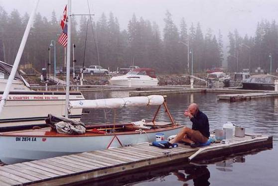
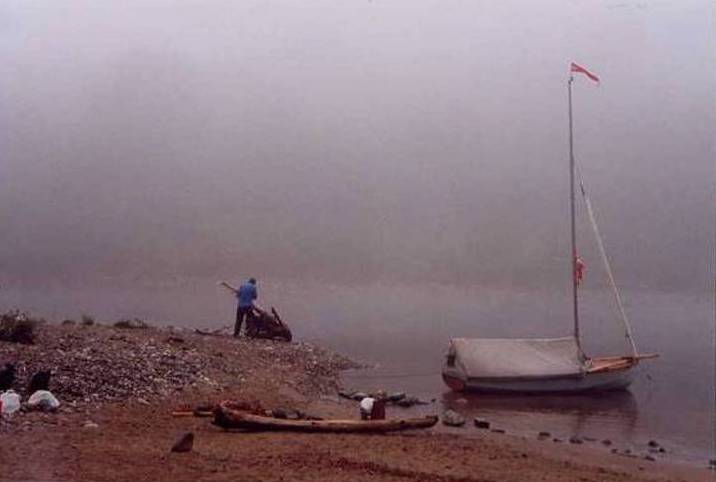
Monday, July 22nd. We launched “Blue Mist” yesterday, but it was too late to go anywhere so we stayed overnight at Buck’s Marine on the Michipicoten River. As a result of yesterday’s rain this morning we were greeted by thick fog. The chill and dampness has us wearing our fleece jackets, while back home Margie tells me it is in the mid-90’s with still no sign of the slightest chance of rain. We are in a different world.
There are several cruising boats holed up here and some of the parties we chatted with last evening. They are making no sign of movement. With a forecast for clearing by afternoon we’ve decide to make a go for it. It is well past noon when we leave the dock. Our original destination of Dog Harbor is 15 NM (nautical miles) away and has me thinking maybe we should head north for Michipicoten Bay, which is only about 4 NM up the coast. There are very few navigational aids on this coast and none marking any of these small harbors. Dog Harbor, which is no more than a small indentation, a miniscule crack in the mountainous shoreline, would be impossible to find in fog. On the other hand, Michipicoten Bay, though I hadn’t been there before, is quite large and should be relatively easy to locate. I punch the coordinates for several waypoints into my new Magellan GPS. Already the investment in both the new GPS and VHF radio are paying off. (Up here my small dry cell battery powered US weather radio doesn’t seem to be working.)
Beating down river against a stiff breeze we are pressed to stay alert in order to avoid the many shoals, as well as an occasional rock or snag. The ex-coastguardsman, skipper of a fancy, sleek twin engine, thirty-footer who attempted to impress us the night before with his know how, hails us from his rubber dinghy. “The waves are really braking hard on the bar at the river mouth”, he says. We’ve been warned! But the bar turns out to be a piece of cake, which makes us wonder about this guy.
Once on the lake we are immediately engulfed in thick fog. After spending so much time sailing Maine’s foggy coast I no longer panic. But as excellent as the British are as sailors and seamen I have noticed in the past that some of my acquaintances were not accustomed to sailing in fog. It pleases me and I’m encouraged to see that Rob isn’t the least bit phased by the fog. For two people who knew nothing about each other until a couple of days ago we are getting along fabulously.
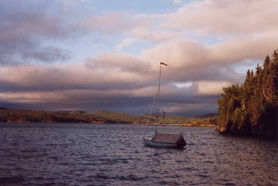
Being under full sail we have all the wind we want. The waves have built to the point where there is an occasional cresting roller, which spills a bit of spray aboard “Blue Mist”. We had donned our heavy duty foul weather stuff over the fleeces before departing. With the wind coming out of the west to southwest Dog harbor would be a really tough beat, not to think of the fog. So I surprise Rob by informing him that we are heading for Michipicoten Bay instead. It is rather large and open, but there is a cove where we should be able to find a safe spot. The hard to find and tricky entrance to the Michipicoten River which we just left is behind us and already lost in the fog. There’s no turning back now. We both take note of the time.
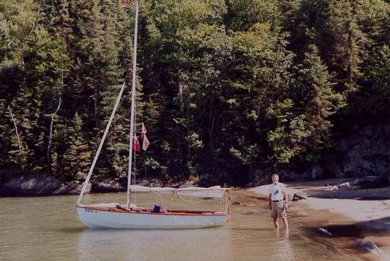
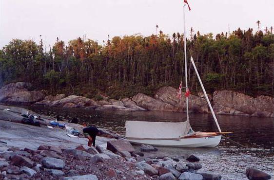
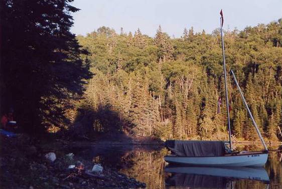
After going out about a quarter mile to avoid any off lying rocks and ledges, I bring us onto a port tack. We are just able to lay a line for Perkwakwia Point, a prominent land mass with a light forming the west side of the bay. At a boat speed of five knots it won’t take long to arrive. Though relaxed and enjoying the sail, our eyes try penetrating the gloom, but to no avail. Sooner than we should we start looking for a dark shadow, or breaking wave, indicating that we are nearing the shore. For a brief second I think I see something, but then it is gone and I’m not sure. Another 15 to 20 minutes go by before the point actually shows itself. Nearing the land the fog now begins breaking up and by the time we locate Oaks Cove we have bright warm sunshine flooding over us. Hopping ashore on a small stretch of white sandy beach we drop the anchor off the boat’s bow and tie a stern line to log, then strip down to T-shirts and shorts. Rob is thrilled. The beach is littered with all kinds of driftwood. “Think we are okay to build a fire?” he queries. Earlier we were informed that there was a ban due to the recent dry spell, but now we had gotten some rain. “Sure, I don’t see why not”, I replied, as I dug the hand ax out of the aft locker and handed it to him, aware that the opportunity for building a campfire on a beautiful deserted sandy beach is not an everyday occurrence in the UK. Also, I’m thinking ahead to dinner. “I have some potatoes for baking in the fire, so make it a good one”, I add. Here I might say that every night throughout the cruise we had a campfire and not once did I have to build it. Also, the baked potatoes took high honors on the food list, which will prompt me to bring along even more on the next cruise.
(To be continued)
Photos
Chart 1
Chart 2
Buck’s Marine
Oak’s Cove 1
Oak’s Cove 2
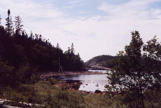
Dog Harbor
Ghost River
Pukaskwa River
Trapper Harbor
Bears at Oiseau Bay
Allouez Island
State Islands
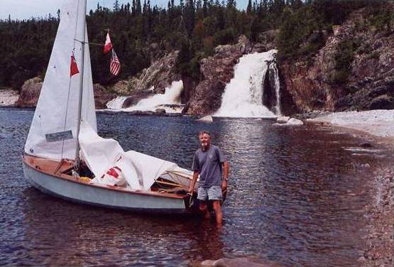
Three Cataract Falls
|