| Round
Georgian Bay by Joy Phillips (W866) * July 17-31, 1973 Part 4: July 23-25 ... |
July 23rd Monday. 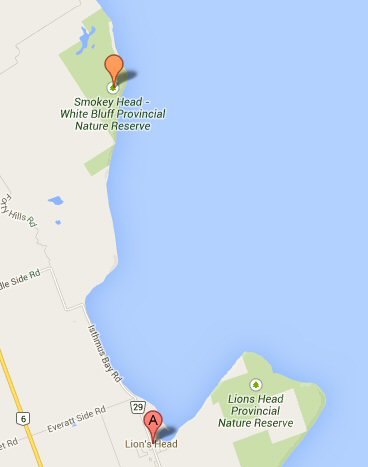 0700
Up.
Breakfast just ready when first W460 and then W1129
appeared, heading for Lion's Head. I went into
town for breakfast supplies for the lot, leaving the
coffee pot on, and Alan to welcome them. It
appeared that Don and Connie had rounded Smoky Head
last night, for Connie saw our sails come down when we
decided to row the last bit across Isthmus Bay.
They holed up for the night just south of Smoky Head.
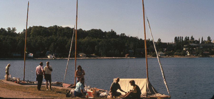
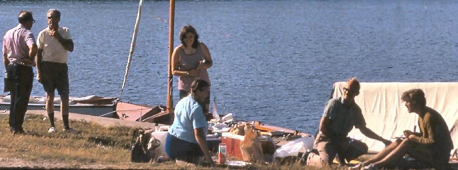
After breakfast, all went into town for supplies and had orange juice at Connie's favorite fish-and-chip shop. The Liverpool couple who had it last year have now left, and it has changed hands. We couldn't have been more pleasantly treated though I should have enjoyed meeting fellow Liverpudlians-in-exile. Alan returned to the boat, and when we all got back, he was found to be ill. Don decided to lay over a day at Lion's Head, and hope Alan is better tomorrow. By previous arrangement, Don called Hugh (Thomas) and found that he had put in at Honey Harbor and will come round to meet us. Diane very kindly offered to bring Hugh's car and trailer tomorrow if Alan is no better, and take us and Kingfisher back to Parry Sound. Aren't W folk kind! While Alan lay
in the boat, shaded by the tent slung over one side
from the boom, and covered by a big sweater and two
sleeping-bags (the temperature that day was about 85F
), and the rest of us spent the day around Lion's
Head. We met Mr. and Mrs. Eric Braundt,
originally from Devonshire and now from near Grimsby,
Ontario, who were most kind. They used to be W-folk,
and still have a very warm spot in their hearts for
Wayfarers, both the wooden and the human variety. They
offered us the use of their guest room in case Alan
became seriously ill, and Mrs. Braundt showed me the
way to their cottage. This is right on the Bruce
Trail, and has a glorious view over the bay. Today the
water was almost like Bahamian water - clear, and
varying shades of blue-green according to depth,
contrasting with the intense white and light grays of
the rocky shore. Mr. and Mrs. Braundt have some very
lovely furniture in the cottage, which is made by a
local farmer during the long, cold winters up here. He
puts alternate strips of light and dark wood, of
varying widths, together, and finishes it
beautifully. He had made everything to fit the
spot where it was to go - table, benches and chairs
for the dining area; bunk beds, of which one was lower
than usual to accommodate the window; drawers to
fit below this bed; and one or two other
pieces. Mrs. Braundt generously gave me some
cans of a special Old English Ginger Beer, more or
less guaranteed (by her, not the manufacturer) to
settle feelings of nausea. Alan drank one later that
evening and felt better!
1600 Alan's temperature 101 . 1745 Now
it's 101.5 . The rest of us went into town for
supper, and the Braundts joined us. Fish and
chips at last, to Connie's delight. Mrs. Braundt
lent us a sleeping bag for me. So that Alan could
still use both of ours, and also an eiderdown to add
to his coverings in case the night got cold.
Fortunately, by late evening, he was beginning to feel
a little better; this has clearly been a bout
of 'flu. On returning to the boat, I made
up some Jello for the convalescent diet next day, and
after a cuppa (definitely a three-bagger this
time!) we all turned in at 2300.
July 24th Tuesday. 0730
Up.
Swim. Breakfast. Alan feeling better, and ate a
simple breakfast, starting with the Jello. The
Braundts came and retrieved their gear. Don and
Pete went into the town and called Diane, letting her
know that we shall be going on today. Wind
forecast 10-15k, and as for direction, Don summed up
every morning's start this cruise - "If you want to
know where the wind is from, just ask where we're
going".
1000 Mr. and Mrs Braundt came to see us off, and to take movies of the flotilla leaving Lion's Head harbor; Pete swung around to pick up the camera when the sequence had been taken. 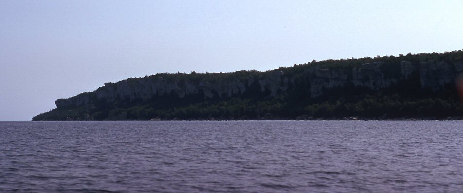 1030 Departed Lion's Head harbor. Wind E, Force 1-2. Waves 4 inches. 1115 Close-hauled, starboard tack, heading 045M Wind ESE, Force 1-2, waves 1-2ft. 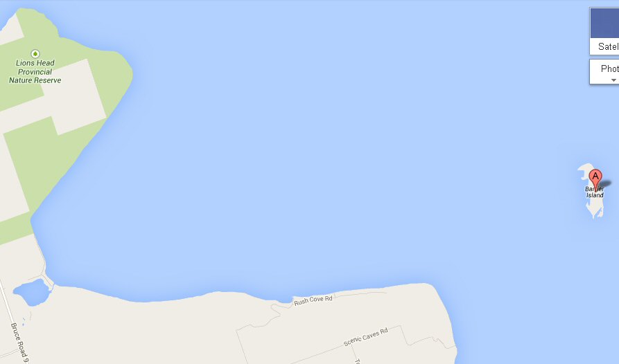 1118 Lion's Head (the point) abeam, about a mile away. Course Lion's Head to Barrier Island, 106T 113M. 1144 Tacked on to port. Glorious morning - this is the life! 1151 Tacked on to starboard because of stick in water ahead - Jackson Shoal? 1207 Tacked on to port; hove to, waited for Don. 1210 Conference: Don not sure whether that was Jackson Shoal. 1211 Sailing again. Close-hauled, starboard tack. Barrier Island bears 160 and lies between McGregor Head and Prairie Point. The coastline
and islands here are remarkable for a series of steep
bluffs usually a mile or so in from the shore.
It is probably due to a cap of hard rock on top of
soft, like the "Flowerpots". The bluffs are
marked on the chart so we decided to try some fixes,
sighting over the boat's compass, and determine our
speed for once, instead of guessing.
1235 Barrier Island in line with King's Point. Bears 175M, 168T. But true should be 158, = 165M. 1242 Tacked to Port. Heading 160M, straight for Barrier Island. Tacked because others had tacked, thus spoiling this line of fixes. Wind lighter, Force 2. 1303 Try again! 1304 Barrier Island now in line with Jones Bluff. Bears 170M, 163T. Bluff we are aiming for bears about 140M, 133T, (Cape Croker.) Lion's Head bears 245M, 238T. Fix worked out well. We are 5 ¾ miles from Lion's Head, 7 ¼ miles to Cape Croker. 1337 Wind falling very light. 1341 Some haze again. 1355 Very light again. 1410
Wind
picking up - Force 2-3. Tacked on to starboard
tack. About this time, I remarked to the log
that I shall feel insecure without a jib sheet in my
hand when we get home; shall have to find some
other piece of line to hold - the vacuum cleaner cord,
perhaps?
1420 Tacked on to port. Wind Force 3. Waves 2ft. Heading 140M, 133T. 1428
Middle
of island in line with Cape Paulett. Bears 195M,
188T. Cape Croker bears 130M, 123T. Lion's Head bears
260M, 25 T. Fix worked out well. Distance made
good - 2 ½ miles in 1 hr 24 min;
1447 Wind falling light again. 1457
Right
hand end of Barrier Island in line with TV tower on
Cape Dundas. Lion's Head bears 283M. 276T
Cape Croker (the bluff) bears 125M, 128T. Fickle Wind
picking up - Force 2-3.
1515 Wind falling light again. 1519 Wind picking up again. 1555 Biggish blue sailboat came out from Cape Croker - under power. What is the matter with these fellows? 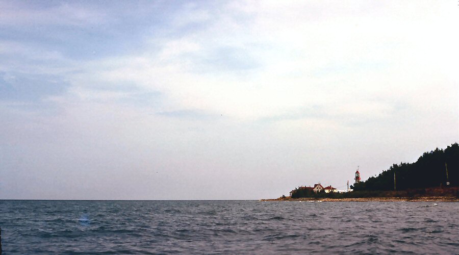 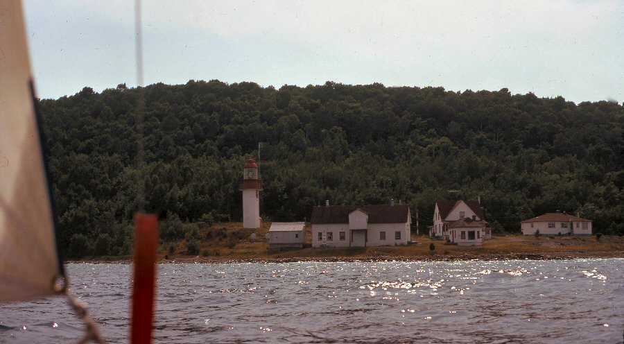 1615 Tacked on to port. Took photo of Lighthouse off Cape Croker. 1635 Don decided to go inside Hay Island. 1641
Round
point from lighthouse. Wind very light and
flukey, rising over trees. We have come too
close in shore; decided to go outside Hay
Island.
1650 Same blue boat as we saw at 1555 passed under sail and power, heading for King's Point Bluff. He seems to have children on board, and may be using power so that they don't get bored. 1658 Breeze a little steadier. At this point in
the log I have noted that the four ticklers down the
luff of the jib seem to have their own
personalities. The top two are plodders who go
about their business without much fuss. The
bottom one is a serene personality who doesn't throw
himself around much. But the second from the
bottom is never satisfied He waves his weather
arm wildly and I dutifully trim. Immediately his
lee arm gesticulates frantically - "Ease, ease,
EASE!" So I do, and at once the weather arm
starts demanding equal time again. Perhaps it is
best to ignore such a show-off, and pay attention to
his more sober brothers.
1721 N end Hay island abeam to starboard. Good steady breeze. Beam reach, port tack. 1745
Looked
at milk, lest on arrival at White Cloud Island we find
a new recipe for butter - "Take half a carton of milk
on a long beam reach......" It was just good, so
we drank it rather than save it for tea which might
have curdled it.
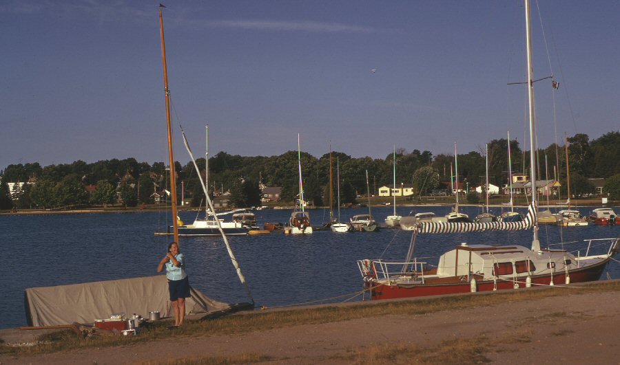
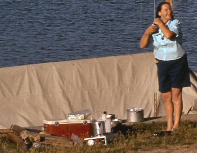
1830 Wind now opposite. Close hauled on starboard tack, into a bay we hope to shelter in.  White Cloud Island, as pretty as its name, is an island about 2 miles by 1 ½, with a nice little bay, Kidd Bay, on the west side. The island lies in the mouth of Colpoy's Bay which is about ten miles long and about a mile and a half wide for most of its length, with Wiarton at its head. Wiarton has been quite a busy port in its day, and is still an important place with wharves, a railway terminal and an airport. Kidd Bay faces down Colpoy's Bay, and has trees coming right down to the shore. There is a wharf marked on the chart, and a mill. We see a nice-looking shore, with a picnic table, but this is marked PRIVATE; it may be connected with the mill, as we see two or three buildings among the trees behind it, and a truck coming down almost to the shore. The wharf is there all right, with a heavy population of visiting boats. People are picnicking, garden chairs and all. A house boat, motor boat and biggish sailing boat are all moored and another big sailing boat is coming in under power (the one we saw coming out from Cape Croker.) There is barbecue smoke rising from the dock, radios blaring, people shouting and all kinds of noise. W866 is there first and we cruise along shore, looking for a good spot. Pete hails: "What is it like?" Alan replies "A bit like Blackpool." 1910
Moored
to shore, as far away from the dock and the crowd as
possible. Supper. The beach here was very
narrow, so that we had to walk right through one
another's 'kitchens', prompting Pete to remark that
they might have made the sidewalks a little wider in
this town!
2200 Turned in for the night, anchored 100 yards out from the shore, with each boat swinging on one anchor set in mud. Alan rigged an anchor light, using the man-overboard light, as traffic was moderately heavy here. We were astonished at the amount of company we had. Mercifully, everyone quieted down fairly early, so that we were able to hear the whippoorwills singing. July 25th Wednesday. 0600 Woke, but since no-one else was awake and we were out from shore, could do nothing till Alan woke, too.   0745
Up
anchors! Each boat chose a different way to get
to shore. Don paddled 460, Tom rowed 1129
and I swam with 866's painter in my teeth. In
case my dentist reads this, let me record at once that
it is astonishingly easy to tow a Wayfarer (in calm
conditions.) It takes very little effort to get
her moving, and after that, you wouldn't know there
was anything behind, except for the presence of the
painter.
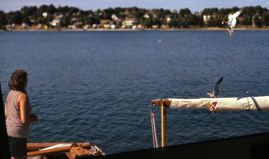
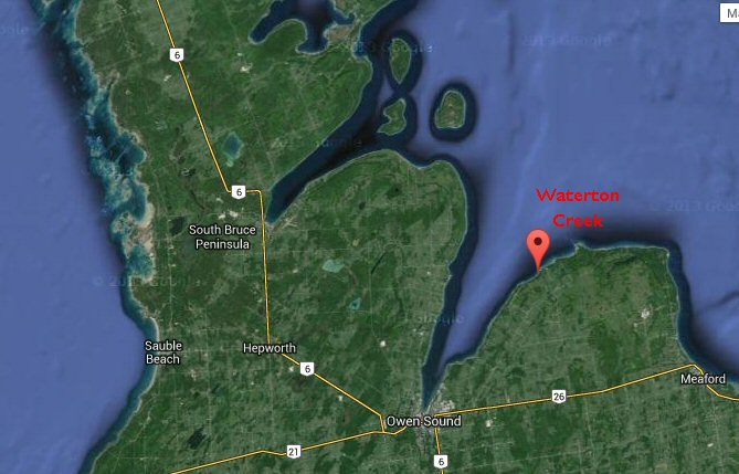 Weather this morning was overcast and gloomy. Radio reported heavy rain in Toronto, which was badly needed but had caused a rash of road accidents. We had breakfast and were just about packed up when the rain started here. Plan: to cross the mouth of Owen Sound and visit a spot near Waterton Creek, where Don and Connie camped last year. Then on to Thornbury. Thanks to Brent Douglas who answered my distress call for information on the next three photos which turn out to have been taken in Owen Sound. As Brent points out "Not sure how this fits into the cruise as you crossed from Colpoys Bay to Vails Point." But Brent has kindly provided the following caption material anyway. 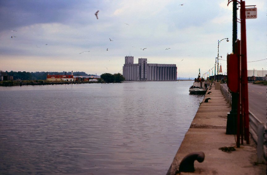 Owen Sound Harbour looking North: the tug is the Paul Evans from the Hindman fleet - click here for larger image 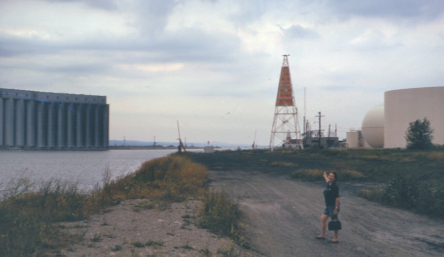 Owen Sound harbour looking north again from the location of the current health unit building. The large tanks to the right have all been removed. 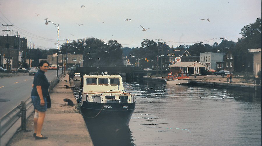 Owen Sound harbour looking south with the old rail bridge in the background. It was torn down in the 80s. 0940 Everyone just underway in foul weather gear and heavy rain. Good breeze, S. 1035 Wind almost gone. Rain only a mist now. Visibility about 4 miles. 1045 Rain stopped. Brightening. Distant thunder. 1057 Very light air. 1103
N.
Keppel bears 190M, 183T. East point White Cloud Island
bears 347M, 340T. Cape Commodore bears 125M, 118T. Fix
worked out pretty well. Heading 120M, 113T.
1130 Wind almost dead. Got out oars: oarlock pin on one almost coming out. Repaired it and resolved to get Wynn oarlocks as soon as possible. (These wrap right around the oar and cannot come apart.) 1138 Sailing by ash breeze! Tom and Pete willing to join us ashore for a brew-up of coffee. Permission requested from Commodore. Granted. 1213 Landed at Cape Commodore, after some trouble finding a spot without private cottages. Commodore and daughter meanwhile had had wieners and beans on board, washed dishes and come ashore reluctantly. They helped us finish the fruitcake. 1320 Off again. Light breeze NNE. No more rain yet. Destination Waterton - no hope of Thornbury tonight. Visibility worsening. Griffith Island not clear. 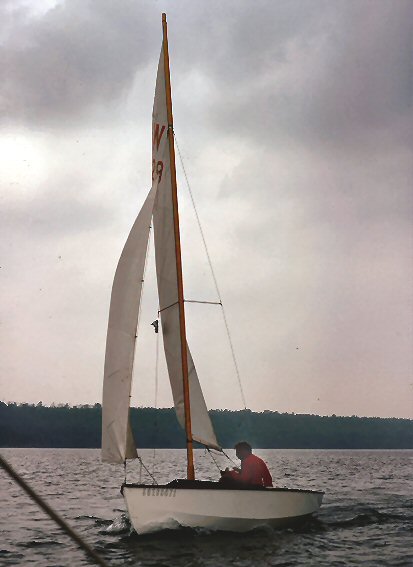 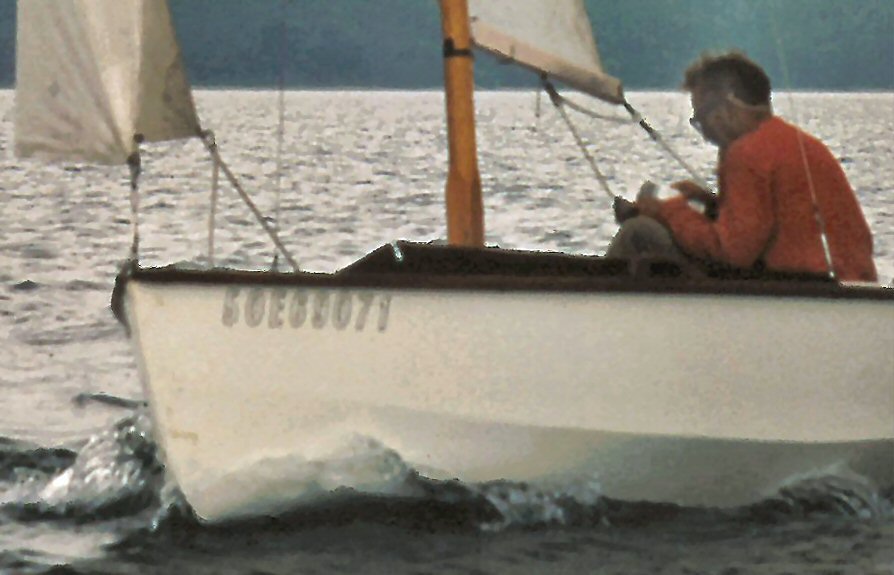 1350 Wind picked up a little. Speed 3kts. 1357 On course. Don steering 148M. Connie taught us two songs - Father Abraham and The Bear Song. 1433 Freshening. Visibility worse - we can't see Vail Head as well as we could fifteen minutes ago. 1518 Spot on navigation! Arrived at Waterton Creek. Decided to sail further as it is so early. 1536 Heading 030M, 023T. 1627 Heading 025M, 018T. 1645
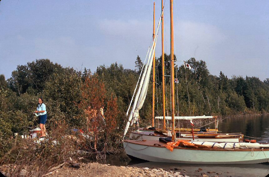
After
a hairy time coming across a very rocky shoal, tied up
at Vail Point. The bay was full of rocks about
two inches under the surface. It was not enough
to have one boat pick a way in and the others
follow; each boat had the crew standing on the
foredeck, warning the skipper of imminent
grounding. We cannot go further tonight, as
there is no shelter for quite a long way after Vail
Point. This spot is less than ideal, not only
for rocks which we can negotiate, but because it is
close to an Army artillery range. We spotted
some Army trucks near the shore, further back round
the bay. Also we have no protection from NW, but
would have to beach our boats or get around the point
if a blow started from there.
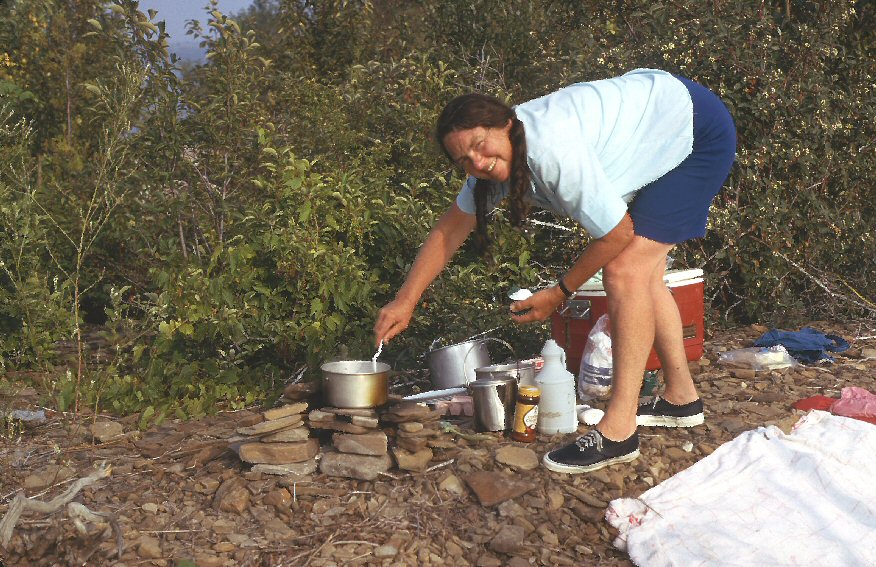
Supper in
leisurely style for once - 866's supper cooked on an
open fire. The rocks here have parallel cleavage
lines and they split into nice rectangular
pieces; Alan built a masterly fireplace.
The light wind is NE, coming right across Georgian Bay
into the fireplace.
Long swim after
doing dishes; and then tea, singing and talk
before turning in, prompting Pete to issue a general
invitation to "Draw up the best rock in the house and
sit down." The Digestive biscuits had gone soft,
and there was a fine opportunity to crisp them on the
hot stones of the fireplace. Cooking on hot
stones is really getting down to basics.
...W866 settled for the night by 2210. Army could be heard singing, shouting, cheering and booing, but not firing, which is O.K. by us. Some of the Ws claim to have heard bagpipes. During the night (0330?) got up to adjust breast-line and anchor-line, as we were grounding on gravel. Heard foghorn, group blasting 3, for a short time. (Must have been a sailing vessel with wind abaft the beam.) |

| next page return to Cruise Logs index |